Area Overview for Crediton Boniface Ward
Photos of Crediton Boniface Ward


Area Information
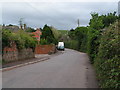
Crediton Boniface Ward is an electoral district within the Mid Devon District Council area, situated in the South West of England. The ward covers a compact area of just 3.4 km², making it a small but distinct community within the broader Crediton town council jurisdiction. This district is represented by six town councillors and two district councillors, ensuring local governance remains closely tied to the specific boundaries defined by the Boundary Commission for England. Living in Crediton Boniface Ward means residing within a well-defined geographical unit that operates under established administrative structures. The ward forms a crucial part of the Crediton area, with its limits mapped out in official documents. Prospective homebuyers looking at this district will find it to be a recognised local administrative zone. The concentration of services and the specific identity of the ward shape daily life for residents in this part of Devon. Understanding the ward's precise location and governance structure is the first step in assessing what it means to call this specific patch of land home.
- Area Type
- District Borough Unitary Ward
- Area Size
- 3.4 km²
- Population
- Not available
- Population Density
- Not available
Demographics
The residents of Crediton Boniface Ward lean heavily towards older age groups, with a median age of 70 years. This demographic profile indicates a community where pensioners and retirees form the largest proportion of the population. While specific age breakdowns for other ranges are not available in the current record, the data confirms that the total population skews significantly older than the national average. Home ownership stands at 66 per cent, meaning more than two in three households in Crediton Boniface Ward own their dwelling outright or with a mortgage. This high rate of ownership typically suggests a stable, settled population with a strong connection to the local nurseries and community facilities. Although detailed figures on household composition and predominant ethnic groups are not listed in the provided statistics, the ownership rate offers a clear picture of the financial standing of the area's inhabitants. A community with such a high level of tenure often responds differently to local development initiatives compared to areas dominated by rental markets. The reliance on owner-occupied housing structures social interactions and property maintenance patterns distinctively within this ward.
Household Size
Accommodation Type
Tenure
Ethnic Group
Religion
Household Composition
Age
Household Deprivation
NS-SEC
Explore more demographic insights in this area
Go to Demographics tabPlanning
Planning Constraints
- Flood RiskPremium
- Ramsar Wetland SitesPremium
- Area of Outstanding Natural BeautyPremium
- Protected Nature ReservePremium
- Protected WoodlandPremium
- Crime RiskPremium