Area Overview for Cothelstone
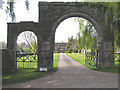
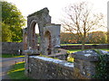
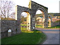
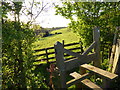
Photos of Cothelstone


Area Information
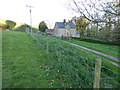
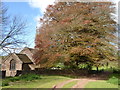
Cothelstone is a small civil parish covering an area of 5.9 square kilometres. It sits within the wider English countryside, offering a compact footprint that defines daily life for its residents. Living in Cothelstone means prioritising space and tranquility over urban convenience. The parish serves as a distinct community unit where residents manage their local affairs within these specific boundaries. This small size often contributes to a slower pace of life compared to larger towns. There are no commercial high streets or major retail parks within the parish limits itself. Instead, the character of the area relies on proximity to nearby villages for essential services. Buyers interested in this location should understand its rural nature immediately. The landscape and location dictate the lifestyle available to those who choose to move here. Homebuyers seek Secluded gardens and open views in such an environment. The lack of industrial development preserves the aesthetic of the land. Anyone considering Cothelstone must weigh the distance to large towns against the benefit of quiet living. This parish represents a choice for those who value a bread-and-b터를 lifestyle above accessibility. The community is defined by its scale and its setting.
- Area Type
- Parish
- Area Size
- 5.9 km²
- Population
- Not available
- Population Density
- Not available
Demographics
The community in Cothelstone reflects a settled population with a clear median age of 70 years. This figure indicates that the majority of residents are either retired or approaching retirement age. The household composition supports this conclusion, showing a demographic profile consistent with a post-retirement village. Homeownership stands at 80 per cent, which creates a stable and long-term community structure. Most residents purchase their properties and remain based in the area for decades. This high rate of ownership reduces transient populations and fosters neighbourhood familiarity. The accommodation types and ethnic diversity data confirm a traditional, homogenous community structure. Residents here have established roots rather than recent migration patterns. The low level of household turnover suggests a deep connection to the local history. Families with younger children are less common compared to other parts of England. The demographic profile suggests that activities and amenities should cater to an older population. Social groups form around shared interests rather than young families starting out. The 80 per cent ownership rate guarantees that new arrivals enter an already settled environment.
Household Size
Accommodation Type
Tenure
Ethnic Group
Religion
Household Composition
Age
Household Deprivation
NS-SEC
Explore more demographic insights in this area
Go to Demographics tabPlanning
Planning Constraints
- Flood RiskLocked
- Ramsar Wetland SitesLocked
- Area of Outstanding Natural BeautyLocked
- Protected Nature ReserveLocked
- Protected WoodlandLocked
- Crime RiskLocked