Area Overview for Corsley
Photos of Corsley
Area Information
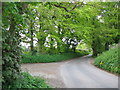
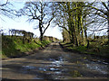
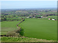
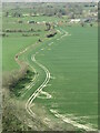
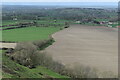
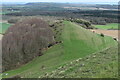
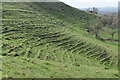
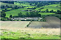
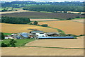
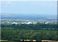
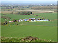
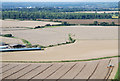
Corsley is a civil parish located in the Warminster district of Wiltshire, extending across an area of 14.5 km² on the border with Somerset. You will find a community defined by its scattered hamlets, including Great Corsley, Little Corsley, Corsley Heath, Whitbourne, Temple, and Leighs Green. These settlements sit within valleys and commons, often traversed by streams like Rodden Brook and Whitbourne. The local landscape is shaped by Upper Greensand geology, though chalk formations create the prominent Cley Hill. The name Corsley likely originates from the Old British word 'Cors', meaning reeds or swamp, reflecting the area's natural history. Life here is grounded in a rural setting that has evolved from historical cloth production and agriculture into a largely pastoral environment. You are walking distance to notable landmarks such as St Margaret of Antioch Church, built in 1833, and St Mary's Church in Temple, which dates back to the turn of the 20th century. The parish offers a distinct pace of living where you encounter historical sites like the former Wesleyan chapel from 1849 and the dye-houses at Sturford and Lower Whitbourne. If you prefer a quiet existence away from commercial centres, Corsley provides a backdrop of ancient geology and historic layers ranging from Celtic entrenchments on Cley Hill to the National School established in 1847. Living in Corsley means embracing a lifestyle where the past is physically present in the stone of every church and the layout of every hamlet.
- Area Type
- Parish
- Area Size
- 14.5 km²
- Population
- Not available
- Population Density
- Not available
Demographics
The community in Corsley is remarkably stable, with home ownership standing at 81%. This high figure indicates that the vast majority of residents are living in properties they have purchased rather than renting. You can expect a quiet domestic atmosphere where families of previous generations have likely stayed put. The area displays a very high median age of 70, suggesting the population is predominantly comprised of retired individuals. While the data categorizes the most common age range as total, the median age provides a clear picture of a mature settlement. There are no indicators of ethnic diversity or religious categorisation within the provided figures, implying a homogenous community structure typical of many rural Wiltshire parishes. The household composition and accommodation type metrics are listed as total, reflecting an aggregation of the residential units across the parish rather than a breakdown of flats versus houses. You are moving into an area where social mobility is low and community ties are strong. The population of around 1,393 residents is spread thin across the 14.5 km², meaning you will know your neighbours for decades. This demographic profile creates an environment perfect for those seeking a predictable, slow-paced life where the community revolves around longstanding local roots and established routines.
Household Size
Accommodation Type
Tenure
Ethnic Group
Religion
Household Composition
Age
Household Deprivation
NS-SEC
Explore more demographic insights in this area
Go to Demographics tabPlanning
Planning Constraints
- Flood RiskPremium
- Ramsar Wetland SitesPremium
- Area of Outstanding Natural BeautyPremium
- Protected Nature ReservePremium
- Protected WoodlandPremium
- Crime RiskPremium