Area Overview for Clevedon Walton Ward
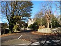
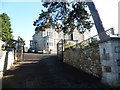
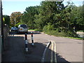
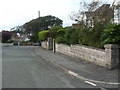
Photos of Clevedon Walton Ward
Area Information
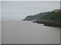
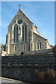
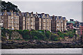
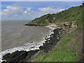
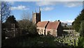
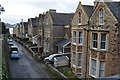
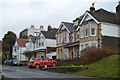
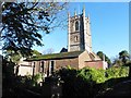
Clevedon Walton Ward is a compact unitary authority ward within North Somerset Council, covering a land area of 1.9 square kilometres. This civil parish ward lies in the heart of the South West region, specifically within the Clevedon civil parish. Its location sits approximately at 51.4468°N and -2.8510°W, identified by the British National Grid reference ST 340641. The ward forms part of the North Somerset parliamentary constituency and is defined by official electoral boundaries set by the Local Government Boundary Commission. Living in Clevedon Walton Ward means residing in a small, precisely defined district that functions as a distinct administrative unit. The area's size contributes to a close-knit environment where residents often know their neighbours. This ward represents a specific slice of the wider Clevedon area, offering a settled character typical of South West England localities. Prospective homeowners seeking a defined boundary within the council structure will find Clevedon Walton Ward to be a clear and manageable locality. The ward's definition through official maps ensures that property boundaries and local governance remain transparent for those purchasing homes in this zone.
- Area Type
- District Borough Unitary Ward
- Area Size
- 1.9 km²
- Population
- Not available
- Population Density
- Not available
Demographics
The community living in Clevedon Walton Ward displays a distinct demographic profile centred on senior residents. The median age for the population is 70, marking this as a mature neighbourhood where older generations dominate the street scene. Home ownership is the primary mode of residence, with 81 per cent of households owning their property outright or with a mortgage. This high level of tenure suggests stability within the local community, as most long-term residents are not dependent on the private rental market. The ward's population structure indicates a society built around retirement or older age groups rather than young families or transient workers. This demographic reality shapes local services and social interactions, focusing on the needs of an elderly populace. Unlike areas with diverse household compositions or mixed age ranges, Clevedon Walton Ward maintains a consistent character defined by its older demographic. The high ownership rate further cements the area's status as a retirement-focused zone where families often grow into empty homes as aging parents move out. Living in Clevedon Walton Ward offers a sense of permanence that aligns with the settled nature of its residents.
Household Size
Accommodation Type
Tenure
Ethnic Group
Religion
Household Composition
Age
Household Deprivation
NS-SEC
Explore more demographic insights in this area
Go to Demographics tabPlanning
Planning Constraints
- Flood RiskPremium
- Ramsar Wetland SitesPremium
- Area of Outstanding Natural BeautyPremium
- Protected Nature ReservePremium
- Protected WoodlandPremium
- Crime RiskPremium