Area Overview for Churchdown Brookfield with Hucclecote Ward
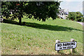
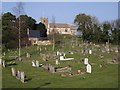
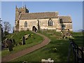
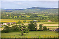
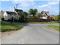
Photos of Churchdown Brookfield with Hucclecote Ward


Area Information
Living in Churchdown Brookfield with Hucclecote Ward offers a compact residential experience within a defined administrative boundary. This specific ward covers an area of 9.2 square kilometres, providing a concentrated environment for its residents. The location serves as a distinct district borough unitary ward in England, creating a clear geographical identity for those seeking homes in this specific locale. You can expect a neighbourhood where daily life unfolds within a relatively contained space. The area functions as a self-contained community, separate from the wider administrative structures of the surrounding region. Anyone considering this spot should understand the scale of their potential home territory. The limited land area suggests a density-focused living experience rather than expansive rural sprawl. When you move to Churchdown Brookfield with Hucclecote Ward, you are entering a zone with specific planning definitions that influence local development and services. This ward status helps define how resources are allocated and how governance is structured for properties in the location. The boundaries are precise, covering exactly 9.2 square kilometres of territory. For families or individuals researching options, the small size means local amenities are likely within short reach without requiring significant travel times across large distances.
- Area Type
- District Borough Unitary Ward
- Area Size
- 9.2 km²
- Population
- Not available
- Population Density
- Not available
Demographics
The community profile of Churchdown Brookfield with Hucclecote Ward reflects a senior population with clear implications for daily life. The median age stands at 70, indicating that roughly half of all residents are 70 years old or older. This age distribution shapes the character of the neighbourhood and influences the types of local services that remain relevant. You are looking at an area where retirement living plays a significant role in the social fabric. The prevailing demographic skew suggests a quiet atmosphere suited to older habits rather than the energy of young families. Home ownership remains the dominant housing arrangement in Churchdown Brookfield with Hucclecote Ward. A full 78 percent of households own their properties outright or with a mortgage, leaving only a minority in the rental sector. This high ownership rate typically correlates with stability and a root for the community, as residents have long-term stakes in their local environment. The data confirms that the area is not driven by student housing or short-term letting. Instead, the stock supports families and individuals who remain for decades. You do not encounter the transience often found in university towns or modern city centres. The environment is built for permanence. Consequently, the social networks here develop slowly and rely heavily on established connections rather than new arrivals.
Household Size
Accommodation Type
Tenure
Ethnic Group
Religion
Household Composition
Age
Household Deprivation
NS-SEC
Explore more demographic insights in this area
Go to Demographics tabPlanning
Planning Constraints
- Flood RiskPremium
- Ramsar Wetland SitesPremium
- Area of Outstanding Natural BeautyPremium
- Protected Nature ReservePremium
- Protected WoodlandPremium
- Crime RiskPremium