Area Overview for Chesterton Ward
Photos of Chesterton Ward
Area Information
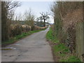
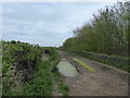
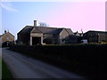
Chesterton Ward stands as a compact, defined neighbourhood within Cambridge, covering a precise area of 1.2 km². This small footprint creates a dense community where living in Chesterton Ward feels intimate yet well-connected to the wider borough. The district operates as a district borough unitary ward, reflecting its administrative importance within the local government structure. You will find this area distinct from larger, sprawling suburbs because of its focused size and integrated local facilities. Daily life here revolves around the immediate vicinity, meaning your morning coffee or evening walk rarely requires venturing far from your doorstep. The concentration of homes in Chesterton Ward fosters a sense of familiarity while maintaining the benefits of urban connectivity. Buying a home in this ward means entering a space where local identity is strong and practical. The area does not offer the wide-open spaces of rural locations but compensates with efficient use of land and accessible infrastructure. Residents here appreciate the balance between a distinct local character and proximity to the cultural hubs of Cambridge. This concentration ensures that essential services remain within easy reach, supporting a lifestyle centred on convenience and community interaction.
- Area Type
- District Borough Unitary Ward
- Area Size
- 1.2 km²
- Population
- Not available
- Population Density
- Not available
Demographics
The community profile of Chesterton Ward presents a clear picture regarding who lives in Chesterton Ward. The median age of residents is 70 years, placing this ward among the most mature areas in the region. Age data indicates that the total population skews significantly towards older adults, reflecting a settlement built for later-life living. Almost half of the total population, specifically 49%, own their homes outright. This high rate of home ownership suggests a stable, settled community where long-term residents have established roots. Household composition data covers the total demographic spread, revealing how families and individuals are organised within this compact space. Accommodation types reflect the needs of this older demographic, with properties likely favoured for their accessibility and low-maintenance requirements. Diversity metrics cover the total ethnic and religious makeup of the ward, although specific breakdowns are aggregated in the total figures. For you, understanding these demographics means knowing that neighbourhood events and community support systems cater primarily to an older audience. Living here offers stability and a peer group of similar age. The 49% ownership rate indicates significant asset wealth within the community, which can translate into better local upkeep and maintenance. You are joining an established social fabric where neighbours have lived through generations of change in a peaceful setting.
Household Size
Accommodation Type
Tenure
Ethnic Group
Religion
Household Composition
Age
Household Deprivation
NS-SEC
Explore more demographic insights in this area
Go to Demographics tabPlanning
Planning Constraints
- Flood RiskPremium
- Ramsar Wetland SitesPremium
- Area of Outstanding Natural BeautyPremium
- Protected Nature ReservePremium
- Protected WoodlandPremium
- Crime RiskPremium