Area Overview for Burstock
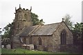
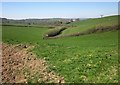
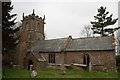
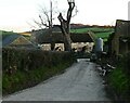
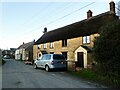
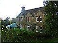
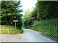
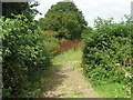
Photos of Burstock


Area Information
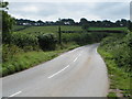
Burstock is a small civil parish situated in England, covering a total land area of 3.8 square kilometres. Life here moves at a deliberate pace, shaped by its compact size and tranquil setting. The community functions as a traditional rural settlement where residents know one another by sight and name. Daily life revolves around the close-knit nature of village living, offering a quiet alternative to faster-paced urban environments. You will find that the immediate surroundings are defined by open spaces and residential streets rather than industrial zones or heavy traffic routes. This limited footprint means that every part of the parish is accessible within short walking distances for most locals. The character of the area remains firmly grounded in its history, providing a stable backdrop for those who settle down. Homebuyers often appreciate the distinct lack of significant commercial development, which preserves the village's original charm. Living in Burstock means choosing a lifestyle where the priority is peace and stability over constant novelty or excitement. The overall atmosphere reflects a community that has grown organically over many years without drastic changes to its physical layout. This consistency creates a predictable environment for families and retirees alike.
- Area Type
- Parish
- Area Size
- 3.8 km²
- Population
- Not available
- Population Density
- Not available
Demographics
The people who call Burstock home represent a distinct demographic profile, with a median age of 70 years. This high median figure indicates that the population is significantly older than the national average, suggesting the area attracts retirees or long-term residents who have stayed through life stages. Over 76 per cent of households own their homes, a figure that stands out among English communities and reflects deep-rooted settlement rather than transient living arrangements. The high ownership rate implies that new arrivals likely purchase properties rather than rent, reinforcing the static nature of the resident base. You will notice that the community lacks young families or students, as evidenced by the population skewed towards older age groups. The demographic composition remains fairly consistent, with no significant fluctuations in household types or accommodation patterns. This stability often appeals to buyers seeking a neighbourhood where neighbours are permanent fixtures. The absence of large transient populations means crime tends to be low and social interactions predictable. When you consider living in Burstock, you are joining a community where life plans are unlikely to change during your tenure.
Household Size
Accommodation Type
Tenure
Ethnic Group
Religion
Household Composition
Age
Household Deprivation
NS-SEC
Explore more demographic insights in this area
Go to Demographics tabPlanning
Planning Constraints
- Flood RiskPremium
- Ramsar Wetland SitesPremium
- Area of Outstanding Natural BeautyPremium
- Protected Nature ReservePremium
- Protected WoodlandPremium
- Crime RiskPremium