Area Overview for BS9 4WD
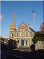
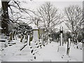
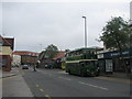
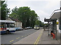
Photos of BS9 4WD
Area Information
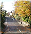
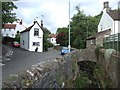
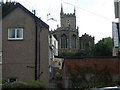
BS9 4WD is a small, tightly knit residential cluster in the northern suburbs of Bristol, England. With a population of just 1,637, it is a quiet, compact area that blends modern living with historical roots. The postcode sits near Southmead, a district known for its healthcare infrastructure, including the sprawling Southmead Hospital, which opened its Brunel Building in 2014. This area is ideal for those seeking a balanced lifestyle, with proximity to essential services and transport links. The community is predominantly composed of adults aged 30–64, reflecting a mature, stable demographic. Daily life here is shaped by easy access to retail, public transport, and natural spaces, though the area’s small size means it is best suited for those prioritising convenience over expansive living. The presence of nearby rail stations and ferry landings ensures connectivity to Bristol’s city centre and beyond, while the low flood risk and absence of environmental constraints make it a practical choice for homebuyers.
- Area Type
- Postcode
- Area Size
- Not available
- Population
- 1637
- Population Density
- 5210 people/km²
BS9 4WD is primarily an owner-occupied area, with 64% of properties owned by residents rather than rented. The accommodation type is predominantly houses, which is unusual for urban areas and suggests a focus on family homes or larger dwellings. This composition indicates a market where properties are likely to be held long-term, reducing competition from short-term rentals or speculative buyers. The small size of the area means that the housing stock is limited, and buyers should consider proximity to nearby suburbs for more options. The presence of houses rather than flats or apartments may appeal to those seeking space and privacy, though it also means the area is not suited for those prioritising high-density living. For first-time buyers, the market may be challenging due to limited availability, but existing owners benefit from a stable, low-volatility environment.
House Prices in BS9 4WD
No properties found in this postcode.
Energy Efficiency in BS9 4WD
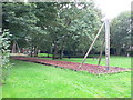
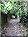
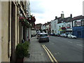
Living in BS9 4WD offers access to a range of practical amenities. Retail options include five nearby stores, such as Morrisons Daily, Tesco Westbury, and Co-op Westbury-on, ensuring everyday shopping needs are met. Public transport is extensive, with five rail stations and five ferry landings providing easy access to Bristol’s cultural and commercial hubs. The area’s proximity to Southmead Hospital and its surrounding facilities adds to its appeal, though it is not a destination for leisure. Parks and green spaces are limited in the immediate area, but nearby Badock’s Wood, with its Bronze Age barrow, offers historical and recreational value. The lifestyle here is functional and low-key, ideal for those prioritising convenience, connectivity, and proximity to essential services over sprawling natural landscapes.
Amenities
Schools
| Rank | School | Type | Entry gender | Ages |
|---|
Explore more schools in this area
Go to Schools tabDemographics
The population of BS9 4WD is 1,637, with a median age of 47. The majority of residents are adults aged 30–64, indicating a mature, established community. Home ownership is high at 64%, with houses being the primary type of accommodation. This suggests a stable, long-term resident base rather than a transient rental market. The predominant ethnic group is White, though no specific diversity statistics are provided. The age profile and ownership rates imply a community focused on family living and long-term investment. The absence of younger demographics or student populations means the area is less likely to experience rapid change. For quality of life, the high home ownership and mature age group suggest a low turnover of properties and a predictable, low-maintenance housing market.
Household Size
Accommodation Type
Tenure
Ethnic Group
Religion
Household Composition
Age
Household Deprivation
NS-SEC
Explore more demographic insights in this area
Go to Demographics tabPlanning
Planning Constraints
- Flood RiskPremium
- Ramsar Wetland SitesPremium
- Area of Outstanding Natural BeautyPremium
- Protected Nature ReservePremium
- Protected WoodlandPremium
- Crime RiskPremium