Area Overview for BS9 4QA
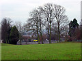
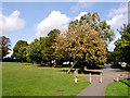
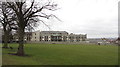
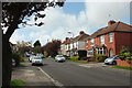
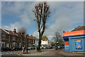
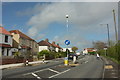
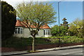
Photos of BS9 4QA
Area Information
BS9 4QA lies within the Westbury-on-Trym and Henleaze electoral ward of Bristol, a small residential cluster in the city’s north. With a population of 1,623, it is a compact area blending interwar housing in Henleaze with the village-origin character of Westbury-on-Trym. The suburb’s origins trace back to the 8th century, with historical roots in a minster church and later rural development that transformed it into a Bristol suburb by the 1920s. Today, it sits between Horfield, Bishopston, and Durdham Downs, offering a mix of suburban tranquillity and proximity to urban amenities. The area is predominantly residential, with most homes built in the 1920s–1930s, featuring semi-detached and detached houses. Residents benefit from nearby rail links, ferry access to the city centre, and a low crime rate. Its compact size and stable community make it a quiet alternative to Bristol’s busier districts, though it remains within reach of the city’s cultural and commercial hubs.
- Area Type
- Postcode
- Area Size
- Not available
- Population
- 1623
- Population Density
- 5000 people/km²
BS9 4QA is a largely owner-occupied area, with 91% of homes owned by residents rather than rented out. The accommodation type is predominantly houses, with few flats or apartments, reflecting its suburban and semi-rural character. This composition suggests a market skewed towards long-term residents seeking stability, rather than a rental-heavy area attracting transient buyers. The small size of the postcode area means property choices are limited to the existing stock of interwar and early 20th-century homes, many of which are semi-detached or detached. For buyers, this implies a focus on acquiring a home rather than investing in rental income. The high home ownership rate also indicates strong local ties, with properties likely retaining value due to the area’s low crime rate and proximity to transport links. However, the limited number of new builds or developments means the market is unlikely to expand significantly.
House Prices in BS9 4QA
No properties found in this postcode.
Energy Efficiency in BS9 4QA
Living in BS9 4QA offers access to a range of local amenities, including retail, transport, and leisure options. The area is served by five retail outlets, including Tesco Henleaze, Co-op Henleaze, and Tesco Bristol, providing everyday shopping needs. Rail stations like Redland and Ashley Down offer frequent services to the city centre, while ferry landings at Castle Park and Welsh Back connect residents to the River Avon and Bristol’s cultural hubs. The proximity to Bristol Filton Airport adds convenience for regional travel. The area’s suburban character blends with nearby parks and green spaces, though specific names are not provided. This mix of practical amenities and transport links supports a lifestyle that balances local convenience with easy access to the city’s amenities, making it suitable for families, commuters, and those seeking a quieter alternative to Bristol’s more densely populated areas.
Amenities
Schools
| Rank | School | Type | Entry gender | Ages |
|---|
Explore more schools in this area
Go to Schools tabDemographics
The population of BS9 4QA is 1,623, with a median age of 47 and the most common age range being adults aged 30–64. This suggests a mature, established community with a strong presence of middle-aged residents, likely including professionals and families. Home ownership is exceptionally high at 91%, indicating long-term residency and a stable housing market. The area is predominantly composed of houses, with few flats or apartments, reflecting its suburban character. The predominant ethnic group is White, though specific diversity statistics are not provided. The high home ownership rate and age profile suggest a community focused on stability and continuity, with limited turnover of properties. This demographic profile aligns with a low deprivation score, implying access to essential services and a generally high quality of life.
Household Size
Accommodation Type
Tenure
Ethnic Group
Religion
Household Composition
Age
Household Deprivation
NS-SEC
Explore more demographic insights in this area
Go to Demographics tabPlanning
Planning Constraints
- Flood RiskPremium
- Ramsar Wetland SitesPremium
- Area of Outstanding Natural BeautyPremium
- Protected Nature ReservePremium
- Protected WoodlandPremium