Area Overview for BS9 4PR
Photos of BS9 4PR
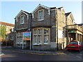
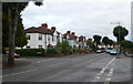
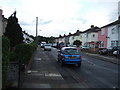
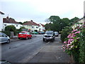
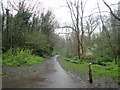
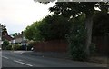
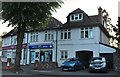
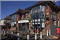
91 photos from this area
Area Information
Key information about the BS9 4PR including its size, population, and administrative classification.
- Area Type
- Postcode
- Area Size
- 9662 m²
- Population
- 1623
- Population Density
- 5000 people/km²
House Prices in BS9 4PR
25
Properties
£385,953
Average Sold Price
£60,000
Lowest Price
£850,000
Highest Price
Showing 25 properties
| Address | Type | Beds | Baths | Last Sale Price | Last Sale Date | |
|---|---|---|---|---|---|---|
| 16 South Croft, Henleaze, Bristol, BS9 4PR | Semi-detached | 3 | 1 | £850,000 | Mar 2025 | |
| 30 South Croft, Henleaze, Bristol, BS9 4PR | house | - | - | £690,000 | Nov 2021 | |
| 42 South Croft, Henleaze, Bristol, BS9 4PR | Semi-detached | 4 | - | £515,000 | Jan 2018 | |
| 26 South Croft, Henleaze, Bristol, BS9 4PR | house | - | - | £575,000 | Jan 2017 | |
| 22 South Croft, Henleaze, Bristol, BS9 4PR | house | - | - | £495,000 | Aug 2016 | |
| 34 South Croft, Henleaze, Bristol, BS9 4PR | Semi-detached | 4 | - | £435,000 | Aug 2014 | |
| 8 South Croft, Henleaze, Bristol, BS9 4PR | Semi-detached | 3 | - | £382,150 | May 2013 | |
| 44A South Croft, Henleaze, Bristol, BS9 4PR | house | - | - | £200,000 | Mar 2013 | |
| 6 South Croft, Henleaze, Bristol, BS9 4PR | house | - | - | £420,000 | Nov 2012 | |
| 4 South Croft, Henleaze, Bristol, BS9 4PR | house | - | - | £385,000 | Sep 2012 |
Page 1 of 3
Energy Efficiency in BS9 4PR
Amenities
Schools
| Rank | School | Type | Entry gender | Ages |
|---|
Explore more schools in this area
Go to Schools tabDemographics
Household Size
Family (3-5 people)
most common
Accommodation Type
Houses
most common
Tenure
91
majority
Ethnic Group
White
most common
Religion
N/A
most common
Household Composition
N/A
most common
Age
47
median
Adults (30-64 years)
most common
Household Deprivation
N/A
with no deprivation
NS-SEC
66
in Lower managerial occupations
Explore more demographic insights in this area
Go to Demographics tabPlanning
Planning Constraints
- Flood RiskPremium
- Ramsar Wetland SitesPremium
- Area of Outstanding Natural BeautyPremium
- Protected Nature ReservePremium
- Protected WoodlandPremium