Area Overview for BS9 3JP
Photos of BS9 3JP
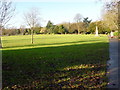
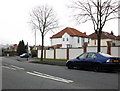

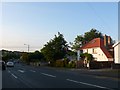
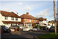


54 photos from this area
Area Information
Key information about the BS9 3JP including its size, population, and administrative classification.
- Area Type
- Postcode
- Area Size
- 1.0 hectares
- Population
- Not available
- Population Density
- Not available
House Prices in BS9 3JP
16
Properties
£498,708
Average Sold Price
£98,000
Lowest Price
£860,000
Highest Price
Showing 16 properties
| Address | Type | Beds | Baths | Last Sale Price | Last Sale Date | |
|---|---|---|---|---|---|---|
| 53 Falcondale Road, Westbury On Trym, Bristol, BS9 3JP | Terraced | 3 | 2 | £640,000 | Aug 2025 | |
| New Croft, 49A Falcondale Road, Westbury On Trym, Bristol, BS9 3JP | Bungalow | 4 | 2 | £860,000 | Dec 2020 | |
| 63 Falcondale Road, Westbury On Trym, Bristol, BS9 3JP | house | 5 | 3 | £660,000 | Oct 2020 | |
| 61 Falcondale Road, Westbury On Trym, Bristol, BS9 3JP | Semi-detached | 5 | 3 | £450,000 | Aug 2018 | |
| 57 Falcondale Road, Westbury On Trym, Bristol, BS9 3JP | Detached | 3 | 3 | £405,500 | Feb 2016 | |
| 73 Falcondale Road, Westbury On Trym, Bristol, BS9 3JP | house | - | - | £560,000 | Nov 2015 | |
| 55 Falcondale Road, Westbury On Trym, Bristol, BS9 3JP | house | 4 | - | £425,000 | Aug 2015 | |
| 49B Falcondale Road, Westbury On Trym, Bristol, BS9 3JP | Detached | 4 | - | £746,000 | Apr 2015 | |
| 75 Falcondale Road, Westbury On Trym, Bristol, BS9 3JP | Semi-detached | 4 | 2 | £470,000 | Nov 2014 | |
| 59 Falcondale Road, Westbury On Trym, Bristol, BS9 3JP | house | - | - | £390,000 | Aug 2013 |
Page 1 of 2
Energy Efficiency in BS9 3JP
Amenities
Schools
| Rank | School | Type | Entry gender | Ages |
|---|
Explore more schools in this area
Go to Schools tabDemographics
Household Size
Two person
most common
Accommodation Type
Houses
most common
Tenure
71
majority
Ethnic Group
White
most common
Religion
N/A
most common
Household Composition
N/A
most common
Age
47
median
Adults (30-64 years)
most common
Household Deprivation
N/A
with no deprivation
NS-SEC
58
in Lower managerial occupations
Explore more demographic insights in this area
Go to Demographics tabPlanning
Planning Constraints
- Flood RiskPremium
- Ramsar Wetland SitesPremium
- Area of Outstanding Natural BeautyPremium
- Protected Nature ReservePremium
- Protected WoodlandPremium