Area Overview for BS9 1ES
Photos of BS9 1ES
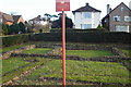
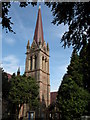
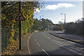
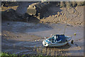
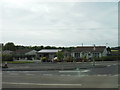
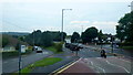
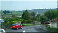
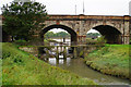
75 photos from this area
Area Information
Key information about the BS9 1ES including its size, population, and administrative classification.
- Area Type
- Postcode
- Area Size
- 2.7 hectares
- Population
- 3461
- Population Density
- 5682 people/km²
House Prices in BS9 1ES
23
Properties
£883,123
Average Sold Price
£308,600
Lowest Price
£1,400,000
Highest Price
Showing 23 properties
| Address | Type | Beds | Baths | Last Sale Price | Last Sale Date | |
|---|---|---|---|---|---|---|
| 35 Old Sneed Road, Stoke Bishop, Bristol, BS9 1ES | Detached | 4 | 2 | £1,400,000 | Mar 2025 | |
| 19 Old Sneed Road, Stoke Bishop, Bristol, BS9 1ES | house | - | - | £925,000 | Feb 2025 | |
| 11 Old Sneed Road, Stoke Bishop, Bristol, BS9 1ES | Semi-detached | 5 | 2 | £1,295,000 | Apr 2024 | |
| 23 Old Sneed Road, Stoke Bishop, Bristol, BS9 1ES | Semi-detached | 5 | 2 | £1,295,000 | Apr 2024 | |
| 13 Old Sneed Road, Stoke Bishop, Bristol, BS9 1ES | house | - | - | £1,295,000 | Jul 2020 | |
| 9 Old Sneed Road, Stoke Bishop, Bristol, BS9 1ES | Semi-detached | 4 | - | £695,000 | May 2014 | |
| 31A Old Sneed Road, Stoke Bishop, Bristol, BS9 1ES | house | - | - | £827,000 | Feb 2014 | |
| 17 Old Sneed Road, Stoke Bishop, Bristol, BS9 1ES | Semi-detached | 5 | - | £640,000 | Apr 2013 | |
| 1 Old Sneed Road, Stoke Bishop, Bristol, BS9 1ES | Detached | - | - | £780,000 | Sep 2012 | |
| 25 Old Sneed Road, Stoke Bishop, Bristol, BS9 1ES | house | - | - | £685,000 | Oct 2011 |
Page 1 of 3
Energy Efficiency in BS9 1ES
Amenities
Schools
| Rank | School | Type | Entry gender | Ages |
|---|
Explore more schools in this area
Go to Schools tabDemographics
Household Size
Two person
most common
Accommodation Type
Houses
most common
Tenure
89
majority
Ethnic Group
White
most common
Religion
N/A
most common
Household Composition
N/A
most common
Age
22
median
Young Adults (15-29 years)
most common
Household Deprivation
N/A
with no deprivation
NS-SEC
21
in Lower managerial occupations
Explore more demographic insights in this area
Go to Demographics tabPlanning
Planning Constraints
- Flood RiskPremium
- Ramsar Wetland SitesPremium
- Area of Outstanding Natural BeautyPremium
- Protected Nature ReservePremium
- Protected WoodlandPremium