Area Overview for BS8 3RA
Photos of BS8 3RA
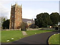
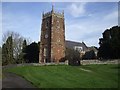
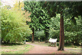
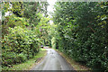
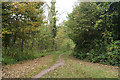
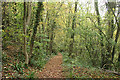
54 photos from this area
Area Information
Key information about the BS8 3RA including its size, population, and administrative classification.
- Area Type
- Postcode
- Area Size
- 77.0 hectares
- Population
- 1432
- Population Density
- 139 people/km²
House Prices in BS8 3RA
28
Properties
£890,000
Average Sold Price
£890,000
Lowest Price
£890,000
Highest Price
Showing 28 properties
| Address | Type | Beds | Baths | Last Sale Price | Last Sale Date | |
|---|---|---|---|---|---|---|
| Myrtle Cottage, Pill Road, Abbots Leigh, BS8 3RA | Detached | 6 | 2 | £890,000 | May 2015 | |
| Mobile Home 1, Karpasia Farm, Pill Road, Abbots Leigh, BS8 3RA | Unknown | - | - | - | - | |
| Coronation Wealth Management Llp, Unit 3, Stable Block Leigh Court, Pill Road, Abbots Leigh, BS8 3RA | office_workshop | - | - | - | - | |
| Unit 1, Stable Block Leigh Court, Pill Road, Abbots Leigh, BS8 3RA | office_workshop | - | - | - | - | |
| Cavendish House Recruitment Ltd, The Stables, Leigh Court Business Centre, Pill Road, Abbots Leigh, BS8 3RA | Office | - | - | - | - | |
| Leigh Court Farm, Pill Road, Abbots Leigh, BS8 3RA | office_workshop | - | - | - | - | |
| Karpasia Farm, Pill Road, Abbots Leigh, BS8 3RA | Farm | - | - | - | - | |
| 252 Pill Road, Abbots Leigh, BS8 3RA | hospital_care_home | - | - | - | - | |
| Flat 2, 252 Pill Road, Abbots Leigh, BS8 3RA | Flat | - | - | - | - | |
| Flat 3, 252 Pill Road, Abbots Leigh, BS8 3RA | Flat | - | - | - | - |
Page 1 of 3
Energy Efficiency in BS8 3RA
Amenities
Schools
| Rank | School | Type | Entry gender | Ages |
|---|
Explore more schools in this area
Go to Schools tabDemographics
Household Size
Two person
most common
Accommodation Type
Houses
most common
Tenure
84
majority
Ethnic Group
White
most common
Religion
N/A
most common
Household Composition
N/A
most common
Age
47
median
Adults (30-64 years)
most common
Household Deprivation
N/A
with no deprivation
NS-SEC
58
in Lower managerial occupations
Explore more demographic insights in this area
Go to Demographics tabPlanning
Planning Constraints
- Flood RiskPremium
- Ramsar Wetland SitesPremium
- Area of Outstanding Natural BeautyPremium
- Protected Nature ReservePremium
- Protected WoodlandPremium