Area Overview for BS8 2PD
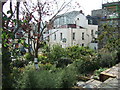
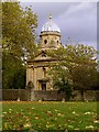
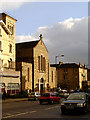
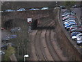
Photos of BS8 2PD

Area Information
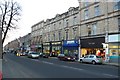
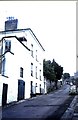
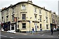
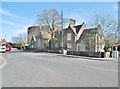
BS8 2PD is a small, residential postcode in the Clifton area of Bristol, covering 0.27 square kilometres. It lies on or near Belgrave Road, within the broader BS8 2 postcode sector. The area is part of Bristol’s urban fabric, with a high population density of 7,467 residents in the wider BS8 district per the 2021 Census. Clifton itself is a historically significant district, known for its mix of Victorian architecture and proximity to the city’s cultural and academic hubs. Daily life here is shaped by nearby institutions such as the University of Bristol’s Canynge Hall and the ALSPAC research centre at Oakfield House. Streets like Whiteladies Road and St. Johns Road are prominent, offering a blend of residential calm and access to local amenities. The area’s compact size means it is tightly integrated with central Bristol, with Clifton Down Station just 0 km away, linking residents to the city’s transport network. While the postcode itself is no longer in active use, the surrounding area remains a focal point for those seeking proximity to both urban convenience and the character of Bristol’s historic districts.
- Area Type
- Postcode
- Area Size
- Not available
- Population
- 1812
- Population Density
- 14014 people/km²
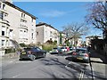
The property market in BS8 2PD is characterised by a high proportion of privately rented homes, with 48.5% of residences in the broader BS8 district being rented. This suggests the area is more of a rental market than an owner-occupied one, though specific data on property types is not provided. The postcode sector is predominantly residential and urban, likely featuring a mix of terraced and semi-detached housing typical of Bristol’s older districts. Given the area’s small size and proximity to Clifton’s amenities, properties here may be sought after by renters prioritising location over long-term ownership. Buyers considering the area should note the limited availability of owner-occupied homes and the potential for competition in the rental market. The compact nature of BS8 2PD means the immediate surrounding area offers similar housing stock, with prices likely influenced by Clifton’s desirability as a Bristol neighbourhood.
House Prices in BS8 2PD
No properties found in this postcode.
Energy Efficiency in BS8 2PD
Amenities
Schools
| Rank | School | Type | Entry gender | Ages |
|---|
Explore more schools in this area
Go to Schools tabDemographics
The BS8 2 postcode sector has 7,467 residents in the broader BS8 district, according to the 2021 Census. Of these, 48.5% live in privately rented homes, indicating a significant rental market. The area’s residential density is high, typical of urban Bristol. No specific data on age distribution or household composition is provided, but the presence of institutions like St. Johns C of E VC Primary School and the University of Bristol suggests a mix of student populations and families. The sector’s proximity to academic and cultural facilities may attract younger professionals and academics. However, deprivation statistics are not included in the data, so no conclusions can be drawn about socioeconomic challenges. The area’s compact size and integration with Clifton’s infrastructure mean residents have access to services and transport, though the high proportion of renters may reflect limited owner-occupied housing stock.
Household Size
Accommodation Type
Tenure
Ethnic Group
Religion
Household Composition
Age
Household Deprivation
NS-SEC
Explore more demographic insights in this area
Go to Demographics tabPlanning
Planning Constraints
- Flood RiskPremium
- Ramsar Wetland SitesPremium
- Area of Outstanding Natural BeautyPremium
- Protected Nature ReservePremium
- Protected WoodlandPremium