Area Overview for BS7 9NG
Photos of BS7 9NG
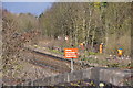

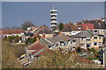
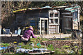

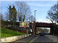
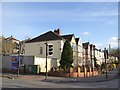
97 photos from this area
Area Information
Key information about the BS7 9NG including its size, population, and administrative classification.
- Area Type
- Postcode
- Area Size
- 7.0 hectares
- Population
- Not available
- Population Density
- Not available
House Prices in BS7 9NG
41
Properties
£173,925
Average Sold Price
£28,000
Lowest Price
£550,000
Highest Price
Showing 41 properties
| Address | Type | Beds | Baths | Last Sale Price | Last Sale Date | |
|---|---|---|---|---|---|---|
| 12 Stottbury Road, Eastville, Bristol, BS7 9NG | Semi-detached | 3 | 1 | £550,000 | Jul 2022 | |
| 80 Stottbury Road, Eastville, Bristol, BS7 9NG | house | - | - | £365,000 | Jun 2021 | |
| 24 Stottbury Road, Eastville, Bristol, BS7 9NG | Semi-detached | 3 | 1 | £347,500 | Jul 2019 | |
| 26 Stottbury Road, Eastville, Bristol, BS7 9NG | Semi-detached | 3 | 1 | £303,500 | Jan 2019 | |
| 38 Stottbury Road, Eastville, Bristol, BS7 9NG | house | - | - | £282,000 | Jan 2016 | |
| 32 Stottbury Road, Eastville, Bristol, BS7 9NG | Semi-detached | 6 | - | £180,000 | Apr 2014 | |
| 70 Stottbury Road, Eastville, Bristol, BS7 9NG | Semi-detached | - | - | £185,000 | Jun 2008 | |
| 78 Stottbury Road, Eastville, Bristol, BS7 9NG | Semi-detached | - | - | £55,000 | May 2006 | |
| 34 Stottbury Road, Eastville, Bristol, BS7 9NG | house | - | - | £55,000 | Apr 2006 | |
| 60 Stottbury Road, Eastville, Bristol, BS7 9NG | Semi-detached | - | - | £54,187 | Apr 2006 |
Page 1 of 5
Energy Efficiency in BS7 9NG
Amenities
Schools
| Rank | School | Type | Entry gender | Ages |
|---|
Explore more schools in this area
Go to Schools tabDemographics
Household Size
Family (3-5 people)
most common
Accommodation Type
Houses
most common
Tenure
58
majority
Ethnic Group
White
most common
Religion
N/A
most common
Household Composition
N/A
most common
Age
47
median
Adults (30-64 years)
most common
Household Deprivation
N/A
with no deprivation
NS-SEC
31
in Lower managerial occupations
Explore more demographic insights in this area
Go to Demographics tabPlanning
Planning Constraints
- Flood RiskPremium
- Ramsar Wetland SitesPremium
- Area of Outstanding Natural BeautyPremium
- Protected Nature ReservePremium
- Protected WoodlandPremium