Area Overview for BS7 9DY
Photos of BS7 9DY


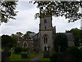

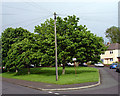
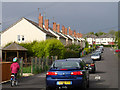


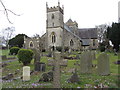
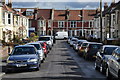
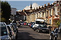
100 photos from this area
Area Information
Key information about the BS7 9DY including its size, population, and administrative classification.
- Area Type
- Postcode
- Area Size
- 9699 m²
- Population
- 1892
- Population Density
- 13881 people/km²
House Prices in BS7 9DY
57
Properties
£431,527
Average Sold Price
£81,000
Lowest Price
£810,000
Highest Price
Showing 57 properties
| Address | Type | Beds | Baths | Last Sale Price | Last Sale Date | |
|---|---|---|---|---|---|---|
| 170 Brynland Avenue, Bishopston, Bristol, BS7 9DY | house | 3 | 2 | £675,000 | Mar 2025 | |
| 124 Brynland Avenue, Bishopston, Bristol, BS7 9DY | Terraced | 5 | 3 | £782,000 | Sep 2024 | |
| 152 Brynland Avenue, Bishopston, Bristol, BS7 9DY | Terraced | 5 | 4 | £810,000 | Apr 2024 | |
| 146 Brynland Avenue, Bishopston, Bristol, BS7 9DY | Terraced | 5 | 2 | £625,000 | Nov 2023 | |
| 130 Brynland Avenue, Bishopston, Bristol, BS7 9DY | house | 3 | 2 | £675,000 | Mar 2023 | |
| 128 Brynland Avenue, Bishopston, Bristol, BS7 9DY | Terraced | 3 | 1 | £695,000 | Feb 2023 | |
| 162 Brynland Avenue, Bishopston, Bristol, BS7 9DY | house | 3 | 2 | £730,000 | Oct 2022 | |
| 138 Brynland Avenue, Bishopston, Bristol, BS7 9DY | Retail | 3 | 2 | £495,000 | Sep 2022 | |
| 110 Brynland Avenue, Bishopston, Bristol, BS7 9DY | Terraced | 6 | 2 | £587,691 | Aug 2022 | |
| 132 Brynland Avenue, Bishopston, Bristol, BS7 9DY | Terraced | 3 | 1 | £590,000 | Sep 2021 |
Page 1 of 6
Energy Efficiency in BS7 9DY
Amenities
Schools
| Rank | School | Type | Entry gender | Ages |
|---|
Explore more schools in this area
Go to Schools tabDemographics
Household Size
Family (3-5 people)
most common
Accommodation Type
Houses
most common
Tenure
64
majority
Ethnic Group
White
most common
Religion
N/A
most common
Household Composition
N/A
most common
Age
47
median
Adults (30-64 years)
most common
Household Deprivation
N/A
with no deprivation
NS-SEC
51
in Lower managerial occupations
Explore more demographic insights in this area
Go to Demographics tabPlanning
Planning Constraints
- Flood RiskPremium
- Ramsar Wetland SitesPremium
- Area of Outstanding Natural BeautyPremium
- Protected Nature ReservePremium
- Protected WoodlandPremium