Area Overview for BS7 9BU
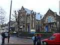
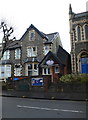
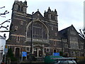
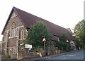
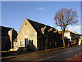
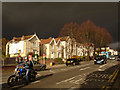
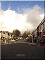
Photos of BS7 9BU

Area Information
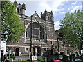
BS7 9BU is a compact residential cluster in northern Bristol, nestled on elevated ground east of the city’s central areas. Covering just 3.3 hectares, this postcode area is home to 2,600 people, translating to a population density of 78,082 per square kilometre — a striking figure that reflects its tightly knit character. Historically, the area was shaped by 19th-century developments, including the consecration of St Michael’s and All Angels church in 1862 and George Müller’s orphanage, which operated until 1958. Today, the neighbourhood is defined by its two- and three-bedroom homes along Ashley Down Road, catering to a community with a median age of 47. The area’s proximity to Ashley Down Railway Station, opened in 2024, and its links to nearby educational and cultural hubs make it a practical choice for those seeking a balance between urban access and residential tranquility.
- Area Type
- Postcode
- Area Size
- 3.3 hectares
- Population
- 2600
- Population Density
- 8811 people/km²
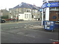
The property market in BS7 9BU is dominated by houses, with 63% of residents owning their homes. This suggests a stable, owner-occupied market rather than a high-rental area. The compact size of the postcode — 3.3 hectares — means housing stock is limited, and buyers may need to consider nearby areas for more options. The prevalence of houses, particularly two- and three-bedroom properties, caters to families and professionals seeking space in a residential setting. Given the area’s proximity to transport links and amenities, properties here are likely to retain value, though the small footprint of the postcode means competition for available homes could be fierce. Buyers should also consider the potential for future development, though no planning constraints are currently flagged.
House Prices in BS7 9BU
Showing 2 properties
| Address | Type | Beds | Baths | Last Sale Price | Last Sale Date | |
|---|---|---|---|---|---|---|
| Davy House, Brunel Centre, Ashley Down Road, Bishopston, Bristol, BS7 9BU | commercial | - | - | - | - | |
| Show Apartment Former Brunel House, Ashley Down Road, Bishopston, Bristol, BS7 9BU | Retail | - | - | - | - |
Energy Efficiency in BS7 9BU
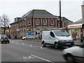
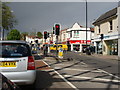
Living in BS7 9BU offers access to a range of amenities within practical reach. Retail options include The Southern Co-operative Co, Sainsburys Bishopston, and Co-op Bristol, providing everyday shopping convenience. The area’s transport network is robust, with Ashley Down Railway Station and multiple ferry landings facilitating both local and regional travel. Parks and open spaces are not explicitly listed, but the area’s historical ties to green spaces, such as the former Müller orphanage site, suggest potential for leisure activities. The presence of the Memorial Stadium and HMP Bristol adds to the area’s character, though recreational facilities may require a short journey. Overall, the mix of retail, transport, and historical sites creates a lifestyle that balances practicality with urban connectivity.
Amenities
Schools
The nearest educational institution to BS7 9BU is Brunel College of Arts and Technology, a sixth-form college offering post-16 education. No primary or secondary schools are listed in the data, meaning families with younger children may need to look beyond the immediate area for schools. The presence of a sixth-form college suggests the neighbourhood is well-served for higher education and vocational training, but those requiring primary or secondary schooling will need to factor in travel time to nearby institutions. The lack of listed schools highlights a potential gap in the area’s infrastructure for younger families, though it does not detract from the appeal for those prioritising post-secondary education.
| Rank | School | Type | Entry gender | Ages |
|---|
Explore more schools in this area
Go to Schools tabDemographics
The population of BS7 9BU is predominantly adults aged 30–64, with a median age of 47. Home ownership stands at 63%, reflecting a mix of owner-occupied properties and rentals. The area is characterised by houses rather than flats, aligning with its suburban residential profile. The predominant ethnic group is White, though specific data on diversity or deprivation is not provided. The demographic suggests a mature, stable community with a strong presence of middle-aged residents. With nearly 30% of the population aged 25–39, the area also accommodates younger professionals and families, contributing to a dynamic but cohesive social fabric. The high population density, while indicative of a compact living environment, does not detract from the area’s appeal as a focused, well-served neighbourhood.
Household Size
Accommodation Type
Tenure
Ethnic Group
Religion
Household Composition
Age
Household Deprivation
NS-SEC
Explore more demographic insights in this area
Go to Demographics tabPlanning
Planning Constraints
- Flood RiskPremium
- Ramsar Wetland SitesPremium
- Area of Outstanding Natural BeautyPremium
- Protected Nature ReservePremium
- Protected WoodlandPremium