Area Overview for BS7 8RZ
Photos of BS7 8RZ


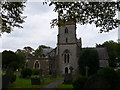
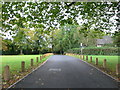
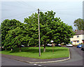
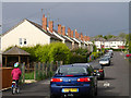

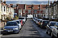
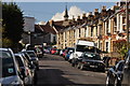
100 photos from this area
Area Information
Key information about the BS7 8RZ including its size, population, and administrative classification.
- Area Type
- Postcode
- Area Size
- 7593 m²
- Population
- Not available
- Population Density
- Not available
House Prices in BS7 8RZ
53
Properties
£276,244
Average Sold Price
£700
Lowest Price
£487,500
Highest Price
Showing 53 properties
| Address | Type | Beds | Baths | Last Sale Price | Last Sale Date | |
|---|---|---|---|---|---|---|
| 86 Oak Road, Bishopston, Bristol, BS7 8RZ | house | 2 | 1 | £450,000 | Mar 2025 | |
| 79 Oak Road, Bishopston, Bristol, BS7 8RZ | Terraced | 3 | 2 | £467,500 | Feb 2025 | |
| 88 Oak Road, Bishopston, Bristol, BS7 8RZ | Terraced | 2 | 1 | £433,620 | Oct 2024 | |
| 55 Oak Road, Bishopston, Bristol, BS7 8RZ | Terraced | 3 | 1 | £487,500 | May 2024 | |
| 90 Oak Road, Bishopston, Bristol, BS7 8RZ | house | 2 | 1 | £451,250 | Dec 2023 | |
| 48 Oak Road, Bishopston, Bristol, BS7 8RZ | Terraced | 2 | 1 | £350,000 | May 2023 | |
| 75 Oak Road, Bishopston, Bristol, BS7 8RZ | house | 3 | 1 | £370,000 | Apr 2022 | |
| 73 Oak Road, Bishopston, Bristol, BS7 8RZ | house | - | - | £356,000 | Apr 2021 | |
| 94 Oak Road, Bishopston, Bristol, BS7 8RZ | house | - | - | £395,000 | Apr 2021 | |
| 49 Oak Road, Bishopston, Bristol, BS7 8RZ | Terraced | 3 | 1 | £375,000 | Nov 2020 |
Page 1 of 6
Energy Efficiency in BS7 8RZ
Amenities
Schools
| Rank | School | Type | Entry gender | Ages |
|---|
Explore more schools in this area
Go to Schools tabDemographics
Household Size
Family (3-5 people)
most common
Accommodation Type
Houses
most common
Tenure
61
majority
Ethnic Group
White
most common
Religion
N/A
most common
Household Composition
N/A
most common
Age
47
median
Adults (30-64 years)
most common
Household Deprivation
N/A
with no deprivation
NS-SEC
43
in Lower managerial occupations
Explore more demographic insights in this area
Go to Demographics tabPlanning
Planning Constraints
- Flood RiskPremium
- Ramsar Wetland SitesPremium
- Area of Outstanding Natural BeautyPremium
- Protected Nature ReservePremium
- Protected WoodlandPremium