Area Overview for BS7 8QG
Photos of BS7 8QG
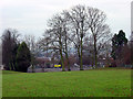
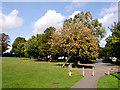
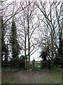
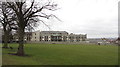
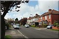
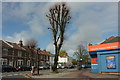
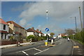
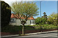
82 photos from this area
Area Information
Key information about the BS7 8QG including its size, population, and administrative classification.
- Area Type
- Postcode
- Area Size
- 6031 m²
- Population
- 1662
- Population Density
- 4556 people/km²
House Prices in BS7 8QG
20
Properties
£419,307
Average Sold Price
£177,000
Lowest Price
£642,000
Highest Price
Showing 20 properties
| Address | Type | Beds | Baths | Last Sale Price | Last Sale Date | |
|---|---|---|---|---|---|---|
| 153 Longmead Avenue, Bishopston, Bristol, BS7 8QG | Terraced | 4 | 1 | £642,000 | Sep 2025 | |
| 167 Longmead Avenue, Bishopston, Bristol, BS7 8QG | Terraced | 3 | 2 | £425,000 | Apr 2024 | |
| 147 Longmead Avenue, Bishopston, Bristol, BS7 8QG | Terraced | 3 | 1 | £480,000 | Mar 2023 | |
| 157 Longmead Avenue, Bishopston, Bristol, BS7 8QG | Terraced | 3 | 1 | £555,000 | Mar 2023 | |
| 145 Longmead Avenue, Bishopston, Bristol, BS7 8QG | Terraced | 3 | 2 | £540,000 | Dec 2022 | |
| 149 Longmead Avenue, Bishopston, Bristol, BS7 8QG | Retail | 4 | 2 | £585,000 | Jun 2022 | |
| 165 Longmead Avenue, Bishopston, Bristol, BS7 8QG | house | 3 | - | £249,800 | Apr 2020 | |
| 153A Longmead Avenue, Bishopston, Bristol, BS7 8QG | Terraced | 4 | 2 | £490,000 | Jun 2019 | |
| 155 Longmead Avenue, Bishopston, Bristol, BS7 8QG | house | 3 | - | £437,500 | Jan 2016 | |
| 131 Longmead Avenue, Bishopston, Bristol, BS7 8QG | Terraced | 3 | 1 | £440,000 | Dec 2015 |
Page 1 of 2
Energy Efficiency in BS7 8QG
Amenities
Schools
| Rank | School | Type | Entry gender | Ages |
|---|
Explore more schools in this area
Go to Schools tabDemographics
Household Size
Family (3-5 people)
most common
Accommodation Type
Houses
most common
Tenure
83
majority
Ethnic Group
White
most common
Religion
N/A
most common
Household Composition
N/A
most common
Age
47
median
Adults (30-64 years)
most common
Household Deprivation
N/A
with no deprivation
NS-SEC
59
in Lower managerial occupations
Explore more demographic insights in this area
Go to Demographics tabPlanning
Planning Constraints
- Flood RiskPremium
- Ramsar Wetland SitesPremium
- Area of Outstanding Natural BeautyPremium
- Protected Nature ReservePremium
- Protected WoodlandPremium