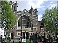
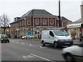
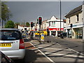
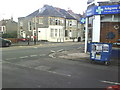
Area Overview for BS7 8PA
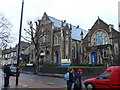
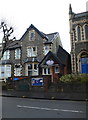
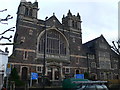
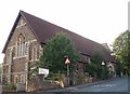
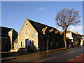
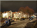
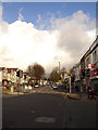
Photos of BS7 8PA

Area Information
BS7 8PA lies within the BS7 postcode district of Bristol, centred at latitude 51.480247 and longitude -2.589431. This small residential cluster is part of the broader BS7 area, which includes the established neighbourhoods of Bishopston and Horfield. The postcode is no longer active for mail delivery, though its historical significance remains. With a population density of 13,531.0 people per square kilometre, the area is densely populated yet retains a suburban character. The average age of 34.9 years suggests a community of young professionals and families, drawn to the district’s amenities and proximity to Bristol’s urban core. Daily life here is shaped by its residential nature, with easy access to local shops, parks, and transport links. The area’s vibrancy is evident in its mix of housing types and the presence of nearby landmarks, though its small size means it is best suited for those seeking a compact, well-serviced environment. Living in BS7 8PA offers a blend of urban convenience and suburban tranquillity, with the postcode’s legacy adding a unique layer to its identity.
- Area Type
- Postcode
- Area Size
- Not available
- Population
- 1679
- Population Density
- 9160 people/km²
The property market in BS7 8PA reflects the broader BS7 postcode district’s status as an affluent area, with an average house price of £566,850—substantially higher than the UK average of £288,000. This suggests strong demand for homes in the area, driven by its proximity to Bristol’s amenities and its suburban appeal. While specific data on home ownership rates or rental activity is not provided, the high property values indicate a market dominated by owner-occupied homes. The area’s compact size means housing stock is likely varied, though the exact types of accommodation are not detailed. Buyers should consider the small postcode’s limited size, which may restrict availability of larger properties. The elevated prices position BS7 8PA as a premium choice, particularly for those prioritising location over expansive living space. Proximity to Bishopston and Horfield adds to its desirability, though the market’s exclusivity is underscored by its financial barriers.
House Prices in BS7 8PA
No properties found in this postcode.
Energy Efficiency in BS7 8PA
Amenities
Schools
| Rank | School | Type | Entry gender | Ages |
|---|
Explore more schools in this area
Go to Schools tabDemographics
The BS7 postcode district has a population density of 13,531.0 people per square kilometre, reflecting a tightly packed residential area. The average age of 34.9 years indicates a community skewed towards young professionals and families, with limited data on household composition or diversity. This age profile suggests a dynamic environment, where career-focused individuals and growing families coexist. The suburban nature of the area, situated within Bishopston and Horfield, aligns with its appeal to those seeking proximity to Bristol’s amenities without the congestion of the city centre. While specific figures on home ownership or deprivation are absent, the high population density and average age imply a mix of long-term residents and newer arrivals. The area’s character is defined by its compact layout and the presence of nearby amenities, though further details on socioeconomic diversity remain unexplored in the available data.
Household Size
Accommodation Type
Tenure
Ethnic Group
Religion
Household Composition
Age
Household Deprivation
NS-SEC
Explore more demographic insights in this area
Go to Demographics tabPlanning
Planning Constraints
- Flood RiskPremium
- Ramsar Wetland SitesPremium
- Area of Outstanding Natural BeautyPremium
- Protected Nature ReservePremium
- Protected WoodlandPremium