Area Overview for BS7 8LD
Photos of BS7 8LD
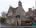
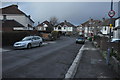
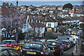
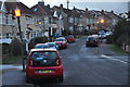


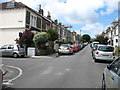
100 photos from this area
Area Information
Key information about the BS7 8LD including its size, population, and administrative classification.
- Area Type
- Postcode
- Area Size
- 5505 m²
- Population
- Not available
- Population Density
- Not available
House Prices in BS7 8LD
32
Properties
£327,586
Average Sold Price
£42,000
Lowest Price
£610,000
Highest Price
Showing 32 properties
| Address | Type | Beds | Baths | Last Sale Price | Last Sale Date | |
|---|---|---|---|---|---|---|
| 54 Melbourne Road, Bishopston, Bristol, BS7 8LD | Terraced | 4 | 2 | £610,000 | Aug 2025 | |
| 84 Melbourne Road, Bishopston, Bristol, BS7 8LD | Terraced | 2 | 1 | £448,000 | Mar 2025 | |
| 82 Melbourne Road, Bishopston, Bristol, BS7 8LD | Terraced | 2 | 1 | £477,500 | Mar 2025 | |
| 78 Melbourne Road, Bishopston, Bristol, BS7 8LD | Terraced | 2 | 1 | £407,500 | Oct 2023 | |
| 74 Melbourne Road, Bishopston, Bristol, BS7 8LD | Terraced | 2 | 1 | £402,500 | Oct 2023 | |
| 76 Melbourne Road, Bishopston, Bristol, BS7 8LD | house | 2 | 1 | £463,500 | Aug 2023 | |
| 90 Melbourne Road, Bishopston, Bristol, BS7 8LD | Terraced | 2 | 1 | £445,000 | Jul 2023 | |
| 42 Melbourne Road, Bishopston, Bristol, BS7 8LD | Terraced | 3 | 1 | £526,500 | Jun 2023 | |
| 88 Melbourne Road, Bishopston, Bristol, BS7 8LD | Terraced | 2 | - | £472,000 | Jun 2022 | |
| 48 Melbourne Road, Bishopston, Bristol, BS7 8LD | Terraced | 2 | - | £450,000 | Feb 2020 |
Page 1 of 4
Energy Efficiency in BS7 8LD
Amenities
Schools
| Rank | School | Type | Entry gender | Ages |
|---|
Explore more schools in this area
Go to Schools tabDemographics
Household Size
Family (3-5 people)
most common
Accommodation Type
Houses
most common
Tenure
76
majority
Ethnic Group
White
most common
Religion
N/A
most common
Household Composition
N/A
most common
Age
47
median
Adults (30-64 years)
most common
Household Deprivation
N/A
with no deprivation
NS-SEC
55
in Lower managerial occupations
Explore more demographic insights in this area
Go to Demographics tabPlanning
Planning Constraints
- Flood RiskPremium
- Ramsar Wetland SitesPremium
- Area of Outstanding Natural BeautyPremium
- Protected Nature ReservePremium
- Protected WoodlandPremium