Area Overview for BS7 8HF
Photos of BS7 8HF
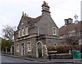
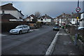
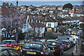
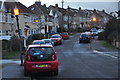
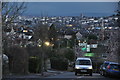

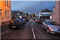


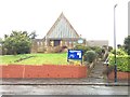
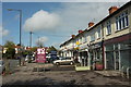
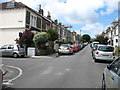
100 photos from this area
Area Information
Key information about the BS7 8HF including its size, population, and administrative classification.
- Area Type
- Postcode
- Area Size
- 1.6 hectares
- Population
- 1542
- Population Density
- 8697 people/km²
House Prices in BS7 8HF
29
Properties
£521,829
Average Sold Price
£130,000
Lowest Price
£985,750
Highest Price
Showing 29 properties
| Address | Type | Beds | Baths | Last Sale Price | Last Sale Date | |
|---|---|---|---|---|---|---|
| 3 Berkeley Road, Bishopston, Bristol, BS7 8HF | Semi-detached | 3 | 3 | £655,000 | Sep 2024 | |
| 5 Berkeley Road, Bishopston, Bristol, BS7 8HF | Semi-detached | 2 | 2 | £620,500 | Feb 2021 | |
| 17 Berkeley Road, Bishopston, Bristol, BS7 8HF | Semi-detached | 5 | 2 | £820,000 | Oct 2019 | |
| 39 Berkeley Road, Bishopston, Bristol, BS7 8HF | house | 5 | 2 | £985,750 | Jul 2017 | |
| 33 Berkeley Road, Bishopston, Bristol, BS7 8HF | Semi-detached | 4 | 1 | £735,000 | Jun 2017 | |
| 27 Berkeley Road, Bishopston, Bristol, BS7 8HF | Semi-detached | 4 | - | £675,000 | Jun 2015 | |
| 23 Berkeley Road, Bishopston, Bristol, BS7 8HF | Semi-detached | 5 | 2 | £718,000 | Apr 2015 | |
| 19 Berkeley Road, Bishopston, Bristol, BS7 8HF | house | 4 | 2 | £550,000 | Dec 2014 | |
| 29 Berkeley Road, Bishopston, Bristol, BS7 8HF | Semi-detached | 4 | - | £491,000 | Feb 2014 | |
| 39A Berkeley Road, Bishopston, Bristol, BS7 8HF | Semi-detached | 5 | 2 | £640,000 | Sep 2011 |
Page 1 of 3
Energy Efficiency in BS7 8HF
Amenities
Schools
| Rank | School | Type | Entry gender | Ages |
|---|
Explore more schools in this area
Go to Schools tabDemographics
Household Size
Family (3-5 people)
most common
Accommodation Type
Houses
most common
Tenure
71
majority
Ethnic Group
White
most common
Religion
N/A
most common
Household Composition
N/A
most common
Age
47
median
Adults (30-64 years)
most common
Household Deprivation
N/A
with no deprivation
NS-SEC
55
in Lower managerial occupations
Explore more demographic insights in this area
Go to Demographics tabPlanning
Planning Constraints
- Flood RiskPremium
- Ramsar Wetland SitesPremium
- Area of Outstanding Natural BeautyPremium
- Protected Nature ReservePremium
- Protected WoodlandPremium