Area Overview for BS7 8BS
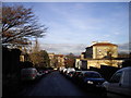
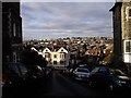
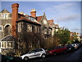
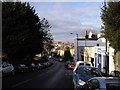
Photos of BS7 8BS
Area Information
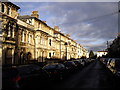
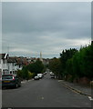
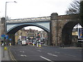
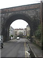
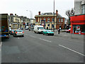
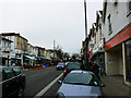
BS7 8BS lies in the heart of Bristol, within the Redland ward, offering a compact urban living experience. Situated 8.6 km from the sea and at an altitude of 40 metres, this postcode is part of the BS7 district, known for its proximity to the city’s cultural and commercial hubs. The area is defined by its high population density—13,531 people per square kilometre—reflecting a tightly knit community. Daily life here is shaped by easy access to transport, with Montpelier station just 0 km away and multiple bus stops within walking distance. The area’s urban character blends with a sense of vibrancy, supported by Bristol’s extensive transport network. With an average age of 34.9 years, the population is young and diverse, comprising 81.3% White, 6.5% Asian, 5.7% Black, and 4.8% Mixed ethnic groups. This mix contributes to a dynamic social fabric, where affordability and connectivity make it appealing to professionals and families alike. Living in BS7 8BS means being immersed in a city that balances historic charm with modern infrastructure, all within a small, well-served postcode cluster.
- Area Type
- Postcode
- Area Size
- Not available
- Population
- Not available
- Population Density
- Not available
The property market in BS7 8BS is characterised by high demand in a small, urban postcode cluster. With a population density of 13,531 people per square kilometre, the area likely features a mix of terraced and semi-detached housing, typical of Bristol’s urban layout. The affluent profile—average household income of £67,500—suggests properties may lean towards higher-end or well-maintained homes, though specific data on home ownership rates is not provided. Given the proximity to Montpelier station and multiple bus routes, the area appeals to commuters and those seeking city-centre convenience. Buyers should consider the limited space within the postcode, which may mean competition for available properties. The urban setting also implies potential for future development, though this remains speculative. For those prioritising transport links and a diverse community, BS7 8BS offers a compact, connected environment within Bristol’s broader network.
House Prices in BS7 8BS
No properties found in this postcode.
Energy Efficiency in BS7 8BS
Amenities
Schools
| Rank | School | Type | Entry gender | Ages |
|---|
Explore more schools in this area
Go to Schools tabDemographics
The community in BS7 8BS is notably young, with an average age of 34.9 years, reflecting a population skewed towards professionals and families. Ethnic diversity is pronounced, with 81.3% identifying as White, 6.5% Asian, 5.7% Black, and 4.8% Mixed. This mix contributes to a culturally rich environment. The area’s deprivation ranking of 21,086 out of 32,844 indicates a relatively affluent profile, with average household incomes of £67,500 in 2020. This suggests strong access to services, employment, and amenities. High population density—13,531 people per square kilometre—points to a compact, urban lifestyle, often associated with higher property values and limited open space. The demographic profile suggests a community prioritising convenience and connectivity, with a mix of household types likely shaped by the area’s urban nature. The low deprivation score implies residents benefit from better infrastructure, healthcare, and educational resources compared to more disadvantaged regions.
Household Size
Accommodation Type
Tenure
Ethnic Group
Religion
Household Composition
Age
Household Deprivation
NS-SEC
Explore more demographic insights in this area
Go to Demographics tabPlanning
Planning Constraints
- Flood RiskPremium
- Ramsar Wetland SitesPremium
- Area of Outstanding Natural BeautyPremium
- Protected Nature ReservePremium
- Protected WoodlandPremium