Area Overview for BS7 8AR
Photos of BS7 8AR


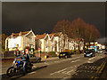
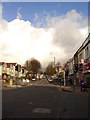
100 photos from this area
Area Information
Key information about the BS7 8AR including its size, population, and administrative classification.
- Area Type
- Postcode
- Area Size
- 1155 m²
- Population
- Not available
- Population Density
- Not available
House Prices in BS7 8AR
12
Properties
£187,250
Average Sold Price
£177,500
Lowest Price
£197,000
Highest Price
Showing 12 properties
| Address | Type | Beds | Baths | Last Sale Price | Last Sale Date | |
|---|---|---|---|---|---|---|
| 38A Gloucester Road, Bishopston, Bristol, BS7 8AR | Maisonette | 2 | 1 | £177,500 | Jul 2021 | |
| Second And Third Floor Flat, 42 Gloucester Road, Bishopston, Bristol, BS7 8AR | Flat | - | - | £197,000 | Sep 2007 | |
| Flat, 36B Gloucester Road, Bishopston, Bristol, BS7 8AR | Flat | - | - | - | - | |
| 36C Gloucester Road, Bishopston, Bristol, BS7 8AR | Flat | - | - | - | - | |
| 38B Gloucester Road, Bishopston, Bristol, BS7 8AR | Flat | - | - | - | - | |
| 42 Gloucester Road, Bishopston, Bristol, BS7 8AR | retail_financial | - | - | - | - | |
| First Floor, 36A Gloucester Road, Bishopston, Bristol, BS7 8AR | Flat | - | - | - | - | |
| 42A Gloucester Road, Bishopston, Bristol, BS7 8AR | Flat | - | - | - | - | |
| Flat, 44 Gloucester Road, Bishopston, Bristol, BS7 8AR | Maisonette | - | - | - | - | |
| 42B Gloucester Road, Bishopston, Bristol, BS7 8AR | Maisonette | - | - | - | - |
Page 1 of 2
Energy Efficiency in BS7 8AR
Amenities
Schools
| Rank | School | Type | Entry gender | Ages |
|---|
Explore more schools in this area
Go to Schools tabDemographics
Household Size
Family (3-5 people)
most common
Accommodation Type
Houses
most common
Tenure
68
majority
Ethnic Group
White
most common
Religion
N/A
most common
Household Composition
N/A
most common
Age
47
median
Adults (30-64 years)
most common
Household Deprivation
N/A
with no deprivation
NS-SEC
56
in Lower managerial occupations
Explore more demographic insights in this area
Go to Demographics tabPlanning
Planning Constraints
- Flood RiskPremium
- Ramsar Wetland SitesPremium
- Area of Outstanding Natural BeautyPremium
- Protected Nature ReservePremium
- Protected WoodlandPremium