Area Overview for BS7 0SE
Photos of BS7 0SE
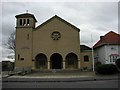
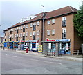
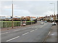
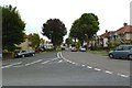
82 photos from this area
Area Information
Key information about the BS7 0SE including its size, population, and administrative classification.
- Area Type
- Postcode
- Area Size
- 1.8 hectares
- Population
- Not available
- Population Density
- Not available
House Prices in BS7 0SE
27
Properties
£402,407
Average Sold Price
£70,000
Lowest Price
£755,000
Highest Price
Showing 27 properties
| Address | Type | Beds | Baths | Last Sale Price | Last Sale Date | |
|---|---|---|---|---|---|---|
| 10 Broncksea Road, Filton, BS7 0SE | house | 3 | 2 | £755,000 | Oct 2025 | |
| 18 Broncksea Road, Filton, BS7 0SE | Retail | 3 | 1 | £480,000 | Sep 2022 | |
| 2B Broncksea Road, Filton, BS7 0SE | Semi-detached | 3 | 1 | £340,050 | Jan 2022 | |
| 25 Broncksea Road, Filton, BS7 0SE | Semi-detached | 6 | 1 | £600,000 | May 2021 | |
| 4 Broncksea Road, Filton, BS7 0SE | Detached | 5 | 3 | £695,000 | Feb 2021 | |
| 12 Broncksea Road, Filton, BS7 0SE | Detached | 4 | 2 | £485,000 | Dec 2018 | |
| 5 Broncksea Road, Filton, BS7 0SE | Semi-detached | 4 | 2 | £508,000 | Jul 2018 | |
| 23 Broncksea Road, Filton, BS7 0SE | Semi-detached | 10 | 10 | £650,000 | Feb 2018 | |
| Amber Lands, 13A Broncksea Road, Filton, BS7 0SE | Detached | 4 | - | £515,000 | Oct 2017 | |
| 2A Broncksea Road, Filton, BS7 0SE | Semi-detached | 3 | 1 | £286,000 | Aug 2017 |
Page 1 of 3
Energy Efficiency in BS7 0SE
Amenities
Schools
| Rank | School | Type | Entry gender | Ages |
|---|
Explore more schools in this area
Go to Schools tabDemographics
Household Size
Family (3-5 people)
most common
Accommodation Type
Houses
most common
Tenure
81
majority
Ethnic Group
White
most common
Religion
N/A
most common
Household Composition
N/A
most common
Age
47
median
Adults (30-64 years)
most common
Household Deprivation
N/A
with no deprivation
NS-SEC
46
in Lower managerial occupations
Explore more demographic insights in this area
Go to Demographics tabPlanning
Planning Constraints
- Flood RiskPremium
- Ramsar Wetland SitesPremium
- Area of Outstanding Natural BeautyPremium
- Protected Nature ReservePremium
- Protected WoodlandPremium