Area Overview for BS7 0LS
Photos of BS7 0LS


Area Information
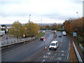
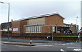
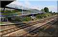
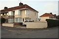
BS7 0LS is a specific postcode located on Filton Avenue in the Horfield area of Bristol, within the BS7 postcode district. This small residential cluster is part of the Filton ward in South Gloucestershire, associated with the Bristol North Delivery Office. Situated at latitude 51.50079 and longitude -2.570103, it lies within the broader Bristol postcode area in South West England. The area is defined by its compact footprint, typical of older postcode allocations, and reflects the historical layout of Bristol’s suburban expansion. Horfield itself is a well-established neighbourhood, known for its mix of residential properties and proximity to the city’s central amenities. Living in BS7 0LS means being part of a tightly defined postcode area that is no longer in active use, suggesting it may be a legacy postcode with limited current relevance. Prospective buyers should consider its location within the broader BS7 district, which connects to nearby areas such as Filton and the wider Bristol transport network. The area’s small size and specific boundaries make it a niche option for those seeking a defined, historic postcode within Bristol’s urban fabric.
- Area Type
- Postcode
- Area Size
- Not available
- Population
- 1587
- Population Density
- 5989 people/km²
The property market in BS7 0LS is shaped by its status as a small, specific postcode area covering a residential cluster. While precise property statistics are not available, the area’s classification as a postcode cluster suggests a limited number of homes, likely including a mix of terraced and semi-detached properties typical of Bristol’s older neighbourhoods. The absence of detailed property listings or price data means buyers must consider the broader BS7 postcode district for comparative insights. As a legacy postcode, BS7 0LS may not be actively marketed, but its proximity to Horfield and Filton could offer access to nearby amenities and transport links. For buyers, this area’s compact nature means competition is likely limited, but the lack of current data on home ownership or rental activity means potential buyers should investigate surrounding postcodes for a fuller picture of the local housing stock and market dynamics.
House Prices in BS7 0LS
No properties found in this postcode.
Energy Efficiency in BS7 0LS
Amenities
Schools
| Rank | School | Type | Entry gender | Ages |
|---|
Explore more schools in this area
Go to Schools tabDemographics
Household Size
Accommodation Type
Tenure
Ethnic Group
Religion
Household Composition
Age
Household Deprivation
NS-SEC
Explore more demographic insights in this area
Go to Demographics tabPlanning
Planning Constraints
- Flood RiskPremium
- Ramsar Wetland SitesPremium
- Area of Outstanding Natural BeautyPremium
- Protected Nature ReservePremium
- Protected WoodlandPremium