Area Overview for BS7 0HA
Photos of BS7 0HA
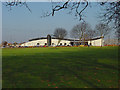
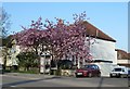
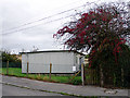
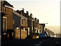
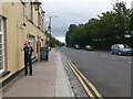
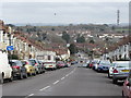
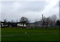
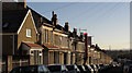
91 photos from this area
Area Information
Key information about the BS7 0HA including its size, population, and administrative classification.
- Area Type
- Postcode
- Area Size
- 4627 m²
- Population
- 2203
- Population Density
- 5304 people/km²
House Prices in BS7 0HA
37
Properties
£286,087
Average Sold Price
£35,000
Lowest Price
£490,000
Highest Price
Showing 37 properties
| Address | Type | Beds | Baths | Last Sale Price | Last Sale Date | |
|---|---|---|---|---|---|---|
| 41 Boston Road, Horfield, Bristol, BS7 0HA | Terraced | 3 | 2 | £475,000 | Oct 2025 | |
| 21 Boston Road, Horfield, Bristol, BS7 0HA | Terraced | 3 | 1 | £450,000 | Jul 2025 | |
| 19 Boston Road, Horfield, Bristol, BS7 0HA | Terraced | 2 | 1 | £415,000 | Mar 2025 | |
| 35 Boston Road, Horfield, Bristol, BS7 0HA | Terraced | 3 | 1 | £357,500 | Mar 2025 | |
| 13 Boston Road, Horfield, Bristol, BS7 0HA | Terraced | 2 | 2 | £490,000 | Mar 2024 | |
| 31 Boston Road, Horfield, Bristol, BS7 0HA | Terraced | 2 | 1 | £428,555 | Jul 2023 | |
| 11 Boston Road, Horfield, Bristol, BS7 0HA | Terraced | 3 | 1 | £460,000 | Sep 2022 | |
| 9 Boston Road, Horfield, Bristol, BS7 0HA | Terraced | 4 | 2 | £415,000 | Sep 2021 | |
| 59 Boston Road, Horfield, Bristol, BS7 0HA | Terraced | 2 | 1 | £324,250 | Mar 2021 | |
| 45 Boston Road, Horfield, Bristol, BS7 0HA | Terraced | 3 | 1 | £400,000 | Jan 2021 |
Page 1 of 4
Energy Efficiency in BS7 0HA
Amenities
Schools
| Rank | School | Type | Entry gender | Ages |
|---|
Explore more schools in this area
Go to Schools tabDemographics
Household Size
Family (3-5 people)
most common
Accommodation Type
Houses
most common
Tenure
52
majority
Ethnic Group
White
most common
Religion
N/A
most common
Household Composition
N/A
most common
Age
47
median
Adults (30-64 years)
most common
Household Deprivation
N/A
with no deprivation
NS-SEC
40
in Lower managerial occupations
Explore more demographic insights in this area
Go to Demographics tabPlanning
Planning Constraints
- Flood RiskPremium
- Ramsar Wetland SitesPremium
- Area of Outstanding Natural BeautyPremium
- Protected Nature ReservePremium
- Protected WoodlandPremium