Area Overview for BS7 0FJ
Photos of BS7 0FJ

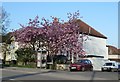
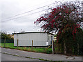

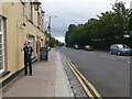
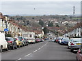


91 photos from this area
Area Information
Key information about the BS7 0FJ including its size, population, and administrative classification.
- Area Type
- Postcode
- Area Size
- 7488 m²
- Population
- 2203
- Population Density
- 5304 people/km²
House Prices in BS7 0FJ
56
Properties
£264,849
Average Sold Price
£165,000
Lowest Price
£415,000
Highest Price
Showing 56 properties
| Address | Type | Beds | Baths | Last Sale Price | Last Sale Date | |
|---|---|---|---|---|---|---|
| 5 Inkerman Close, Horfield, Bristol, BS7 0FJ | Unknown | - | - | £240,000 | May 2025 | |
| 28 Sevastopol Road, Horfield, Bristol, BS7 0FJ | Terraced | 3 | 3 | £330,000 | Sep 2024 | |
| 26 Sevastopol Road, Horfield, Bristol, BS7 0FJ | Terraced | 3 | 1 | £330,000 | Jun 2022 | |
| 7 Sevastopol Road, Horfield, Bristol, BS7 0FJ | Terraced | 3 | 2 | £415,000 | Mar 2022 | |
| 19 Sevastopol Road, Horfield, Bristol, BS7 0FJ | Maisonette | - | - | £263,000 | Mar 2022 | |
| 5 Sevastopol Road, Horfield, Bristol, BS7 0FJ | Flat | 2 | 1 | £410,000 | Dec 2021 | |
| 12 Sevastopol Road, Horfield, Bristol, BS7 0FJ | Terraced | 3 | 2 | £280,000 | Sep 2021 | |
| 24 Sevastopol Road, Horfield, Bristol, BS7 0FJ | Semi-detached | 3 | 3 | £305,000 | Jul 2021 | |
| 2 Sevastopol Road, Horfield, Bristol, BS7 0FJ | Terraced | 4 | 4 | £279,950 | Jun 2021 | |
| 8 Sevastopol Road, Horfield, Bristol, BS7 0FJ | Terraced | 4 | 4 | £349,750 | Mar 2020 |
Page 1 of 6
Energy Efficiency in BS7 0FJ
Amenities
Schools
| Rank | School | Type | Entry gender | Ages |
|---|
Explore more schools in this area
Go to Schools tabDemographics
Household Size
Family (3-5 people)
most common
Accommodation Type
Houses
most common
Tenure
52
majority
Ethnic Group
White
most common
Religion
N/A
most common
Household Composition
N/A
most common
Age
47
median
Adults (30-64 years)
most common
Household Deprivation
N/A
with no deprivation
NS-SEC
40
in Lower managerial occupations
Explore more demographic insights in this area
Go to Demographics tabPlanning
Planning Constraints
- Flood RiskPremium
- Ramsar Wetland SitesPremium
- Area of Outstanding Natural BeautyPremium
- Protected Nature ReservePremium
- Protected WoodlandPremium