Area Overview for BS7 0BY
Photos of BS7 0BY
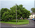
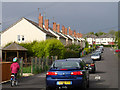
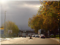
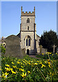
100 photos from this area
Area Information
Key information about the BS7 0BY including its size, population, and administrative classification.
- Area Type
- Postcode
- Area Size
- 5586 m²
- Population
- Not available
- Population Density
- Not available
House Prices in BS7 0BY
22
Properties
£327,721
Average Sold Price
£107,000
Lowest Price
£560,000
Highest Price
Showing 22 properties
| Address | Type | Beds | Baths | Last Sale Price | Last Sale Date | |
|---|---|---|---|---|---|---|
| 18 Parkstone Avenue, Horfield, Bristol, BS7 0BY | Terraced | 3 | 2 | £494,000 | Apr 2025 | |
| 14 Parkstone Avenue, Horfield, Bristol, BS7 0BY | Terraced | 3 | 1 | £435,000 | Mar 2025 | |
| 26 Parkstone Avenue, Horfield, Bristol, BS7 0BY | Terraced | 3 | 1 | £487,500 | May 2024 | |
| 12 Parkstone Avenue, Horfield, Bristol, BS7 0BY | Terraced | 4 | 2 | £560,000 | Dec 2022 | |
| 10 Parkstone Avenue, Horfield, Bristol, BS7 0BY | Terraced | 6 | 2 | £517,555 | May 2022 | |
| 8 Parkstone Avenue, Horfield, Bristol, BS7 0BY | house | 6 | 2 | £385,000 | May 2022 | |
| 34 Parkstone Avenue, Horfield, Bristol, BS7 0BY | house | 3 | 1 | £329,000 | Mar 2020 | |
| 30 Parkstone Avenue, Horfield, Bristol, BS7 0BY | Terraced | 4 | 2 | £410,000 | Jul 2019 | |
| 4 Parkstone Avenue, Horfield, Bristol, BS7 0BY | house | - | - | £342,500 | Sep 2018 | |
| 38 Parkstone Avenue, Horfield, Bristol, BS7 0BY | Terraced | 3 | - | £333,026 | Mar 2017 |
Page 1 of 3
Energy Efficiency in BS7 0BY
Amenities
Schools
| Rank | School | Type | Entry gender | Ages |
|---|
Explore more schools in this area
Go to Schools tabDemographics
Household Size
Family (3-5 people)
most common
Accommodation Type
Houses
most common
Tenure
63
majority
Ethnic Group
White
most common
Religion
N/A
most common
Household Composition
N/A
most common
Age
47
median
Adults (30-64 years)
most common
Household Deprivation
N/A
with no deprivation
NS-SEC
44
in Lower managerial occupations
Explore more demographic insights in this area
Go to Demographics tabPlanning
Planning Constraints
- Flood RiskPremium
- Ramsar Wetland SitesPremium
- Area of Outstanding Natural BeautyPremium
- Protected Nature ReservePremium
- Protected WoodlandPremium