Area Overview for BS6 7SY
Photos of BS6 7SY
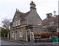
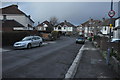
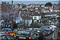
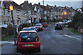
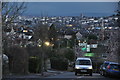
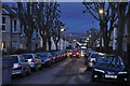
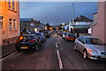


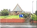
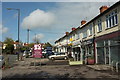
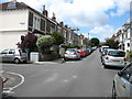
100 photos from this area
Area Information
Key information about the BS6 7SY including its size, population, and administrative classification.
- Area Type
- Postcode
- Area Size
- 3363 m²
- Population
- 1709
- Population Density
- 7868 people/km²
House Prices in BS6 7SY
18
Properties
£466,682
Average Sold Price
£215,000
Lowest Price
£755,000
Highest Price
Showing 18 properties
| Address | Type | Beds | Baths | Last Sale Price | Last Sale Date | |
|---|---|---|---|---|---|---|
| 182 Coldharbour Road, Westbury Park, Bristol, BS6 7SY | Terraced | 5 | 2 | £600,500 | Jan 2024 | |
| 162 Coldharbour Road, Westbury Park, Bristol, BS6 7SY | Terraced | 4 | 2 | £755,000 | Aug 2022 | |
| 164 Coldharbour Road, Westbury Park, Bristol, BS6 7SY | house | 3 | 1 | £570,000 | Jan 2022 | |
| 174 Coldharbour Road, Westbury Park, Bristol, BS6 7SY | Terraced | 3 | 1 | £590,000 | Aug 2018 | |
| 186 Coldharbour Road, Westbury Park, Bristol, BS6 7SY | Terraced | 2 | 1 | £600,000 | Aug 2017 | |
| 168 Coldharbour Road, Westbury Park, Bristol, BS6 7SY | house | - | - | £561,000 | May 2016 | |
| 170 Coldharbour Road, Westbury Park, Bristol, BS6 7SY | house | - | - | £485,000 | Aug 2015 | |
| 160 Coldharbour Road, Westbury Park, Bristol, BS6 7SY | Terraced | 4 | 2 | £250,000 | Mar 2009 | |
| 166 Coldharbour Road, Westbury Park, Bristol, BS6 7SY | Terraced | - | - | £262,000 | Apr 2005 | |
| 178 Coldharbour Road, Westbury Park, Bristol, BS6 7SY | Detached | 8 | 3 | £215,000 | Jan 2003 |
Page 1 of 2
Energy Efficiency in BS6 7SY
Amenities
Schools
| Rank | School | Type | Entry gender | Ages |
|---|
Explore more schools in this area
Go to Schools tabDemographics
Household Size
Family (3-5 people)
most common
Accommodation Type
Houses
most common
Tenure
71
majority
Ethnic Group
White
most common
Religion
N/A
most common
Household Composition
N/A
most common
Age
47
median
Adults (30-64 years)
most common
Household Deprivation
N/A
with no deprivation
NS-SEC
59
in Lower managerial occupations
Explore more demographic insights in this area
Go to Demographics tabPlanning
Planning Constraints
- Flood RiskPremium
- Ramsar Wetland SitesPremium
- Area of Outstanding Natural BeautyPremium
- Protected Nature ReservePremium
- Protected WoodlandPremium