Area Overview for BS6 7RW
Photos of BS6 7RW
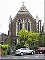


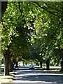
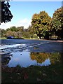
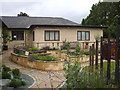

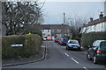
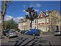
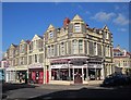
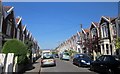
100 photos from this area
Area Information
Key information about the BS6 7RW including its size, population, and administrative classification.
- Area Type
- Postcode
- Area Size
- 6880 m²
- Population
- Not available
- Population Density
- Not available
House Prices in BS6 7RW
17
Properties
£507,535
Average Sold Price
£219,000
Lowest Price
£970,000
Highest Price
Showing 17 properties
| Address | Type | Beds | Baths | Last Sale Price | Last Sale Date | |
|---|---|---|---|---|---|---|
| 53 Linden Road, Westbury Park, Bristol, BS6 7RW | Semi-detached | 4 | 2 | £801,000 | Nov 2025 | |
| 65 Linden Road, Westbury Park, Bristol, BS6 7RW | Terraced | 3 | 1 | £705,000 | Sep 2024 | |
| 73 Linden Road, Westbury Park, Bristol, BS6 7RW | Semi-detached | 5 | 3 | £890,000 | Sep 2024 | |
| 63 Linden Road, Westbury Park, Bristol, BS6 7RW | house | 6 | 3 | £970,000 | Aug 2023 | |
| 69 Linden Road, Westbury Park, Bristol, BS6 7RW | house | - | - | £290,000 | Mar 2013 | |
| 57 Linden Road, Westbury Park, Bristol, BS6 7RW | Semi-detached | - | - | £525,000 | Oct 2008 | |
| 49 Linden Road, Westbury Park, Bristol, BS6 7RW | Semi-detached | - | - | £456,000 | Jan 2007 | |
| 61 Linden Road, Westbury Park, Bristol, BS6 7RW | Semi-detached | - | - | £430,000 | Oct 2005 | |
| 77 Linden Road, Westbury Park, Bristol, BS6 7RW | Detached | - | - | £445,000 | Apr 2004 | |
| 67 Linden Road, Westbury Park, Bristol, BS6 7RW | Terraced | - | - | £299,950 | Oct 2003 |
Page 1 of 2
Energy Efficiency in BS6 7RW
Amenities
Schools
| Rank | School | Type | Entry gender | Ages |
|---|
Explore more schools in this area
Go to Schools tabDemographics
Household Size
Family (3-5 people)
most common
Accommodation Type
Houses
most common
Tenure
66
majority
Ethnic Group
White
most common
Religion
N/A
most common
Household Composition
N/A
most common
Age
47
median
Adults (30-64 years)
most common
Household Deprivation
N/A
with no deprivation
NS-SEC
61
in Lower managerial occupations
Explore more demographic insights in this area
Go to Demographics tabPlanning
Planning Constraints
- Flood RiskPremium
- Ramsar Wetland SitesPremium
- Area of Outstanding Natural BeautyPremium
- Protected Nature ReservePremium
- Protected WoodlandPremium