Area Overview for BS6 7QQ
Photos of BS6 7QQ
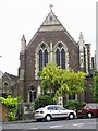

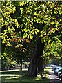
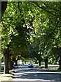
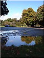
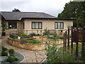

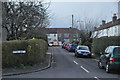
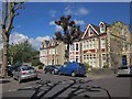
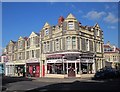
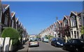
100 photos from this area
Area Information
Key information about the BS6 7QQ including its size, population, and administrative classification.
- Area Type
- Postcode
- Area Size
- 1.9 hectares
- Population
- 1464
- Population Density
- 4924 people/km²
House Prices in BS6 7QQ
8
Properties
£1,455,222
Average Sold Price
£850,000
Lowest Price
£1,925,000
Highest Price
Showing 8 properties
| Address | Type | Beds | Baths | Last Sale Price | Last Sale Date | |
|---|---|---|---|---|---|---|
| 19 Downs Park West, Westbury Park, Bristol, BS6 7QQ | Detached | 6 | 4 | £1,925,000 | Feb 2025 | |
| 17 Downs Park West, Westbury Park, Bristol, BS6 7QQ | Detached | 4 | 1 | £1,701,109 | Dec 2024 | |
| 5 Downs Park West, Westbury Park, Bristol, BS6 7QQ | house | - | - | £1,350,000 | Nov 2017 | |
| 21 Downs Park West, Westbury Park, Bristol, BS6 7QQ | house | - | - | £1,450,000 | Jul 2017 | |
| 15 Downs Park West, Westbury Park, Bristol, BS6 7QQ | Detached | - | - | £850,000 | Jan 2005 | |
| 1 Downs Park West, Westbury Park, Bristol, BS6 7QQ | Semi-detached | 4 | 1 | - | - | |
| Stokeleigh Lodge, 3 Downs Park West, Westbury Park, Bristol, BS6 7QQ | hospital_care_home | - | - | - | - | |
| 7 Downs Park West, Westbury Park, Bristol, BS6 7QQ | Detached | - | - | - | - |
Energy Efficiency in BS6 7QQ
Amenities
Schools
| Rank | School | Type | Entry gender | Ages |
|---|
Explore more schools in this area
Go to Schools tabDemographics
Household Size
Two person
most common
Accommodation Type
Houses
most common
Tenure
73
majority
Ethnic Group
White
most common
Religion
N/A
most common
Household Composition
N/A
most common
Age
47
median
Adults (30-64 years)
most common
Household Deprivation
N/A
with no deprivation
NS-SEC
57
in Lower managerial occupations
Explore more demographic insights in this area
Go to Demographics tabPlanning
Planning Constraints
- Flood RiskPremium
- Ramsar Wetland SitesPremium
- Area of Outstanding Natural BeautyPremium
- Protected Nature ReservePremium
- Protected WoodlandPremium