Area Overview for BS6 7NZ
Photos of BS6 7NZ
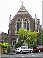

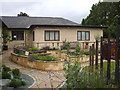

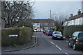
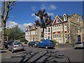
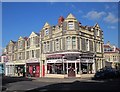
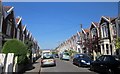
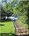
100 photos from this area
Area Information
Key information about the BS6 7NZ including its size, population, and administrative classification.
- Area Type
- Postcode
- Area Size
- 2489 m²
- Population
- 1464
- Population Density
- 4924 people/km²
House Prices in BS6 7NZ
14
Properties
£655,083
Average Sold Price
£468,000
Lowest Price
£1,000,000
Highest Price
Showing 14 properties
| Address | Type | Beds | Baths | Last Sale Price | Last Sale Date | |
|---|---|---|---|---|---|---|
| 19 Etloe Road, Westbury Park, Bristol, BS6 7NZ | Terraced | 3 | 2 | £735,000 | Sep 2023 | |
| 23 Etloe Road, Westbury Park, Bristol, BS6 7NZ | house | - | - | £1,000,000 | Nov 2022 | |
| 27 Etloe Road, Westbury Park, Bristol, BS6 7NZ | house | - | - | £600,000 | Dec 2020 | |
| 17 Etloe Road, Westbury Park, Bristol, BS6 7NZ | Terraced | 3 | 2 | £607,500 | Jun 2020 | |
| 15 Etloe Road, Westbury Park, Bristol, BS6 7NZ | Semi-detached | 3 | - | £468,000 | Sep 2016 | |
| 21 Etloe Road, Westbury Park, Bristol, BS6 7NZ | house | - | - | £520,000 | Feb 2014 | |
| 25 Etloe Road, Westbury Park, Bristol, BS6 7NZ | Terraced | - | - | - | - | |
| 15A Etloe Road, Westbury Park, Bristol, BS6 7NZ | office_workshop | - | - | - | - | |
| 13 Etloe Road, Westbury Park, Bristol, BS6 7NZ | Office | - | - | - | - | |
| 29A Etloe Road, Westbury Park, Bristol, BS6 7NZ | Flat | - | - | - | - |
Page 1 of 2
Energy Efficiency in BS6 7NZ
Amenities
Schools
| Rank | School | Type | Entry gender | Ages |
|---|
Explore more schools in this area
Go to Schools tabDemographics
Household Size
Two person
most common
Accommodation Type
Houses
most common
Tenure
73
majority
Ethnic Group
White
most common
Religion
N/A
most common
Household Composition
N/A
most common
Age
47
median
Adults (30-64 years)
most common
Household Deprivation
N/A
with no deprivation
NS-SEC
57
in Lower managerial occupations
Explore more demographic insights in this area
Go to Demographics tabPlanning
Planning Constraints
- Flood RiskPremium
- Ramsar Wetland SitesPremium
- Area of Outstanding Natural BeautyPremium
- Protected Nature ReservePremium
- Protected WoodlandPremium