Area Overview for BS6 6YB
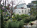
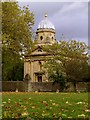
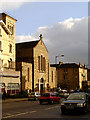
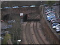
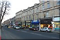
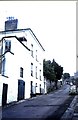
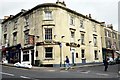
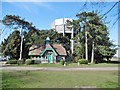
Photos of BS6 6YB

Area Information
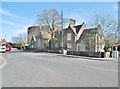
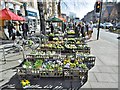
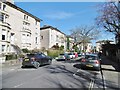
BS6 6YB is a small residential postcode area in the Redland district of Bristol, located at coordinates 51.471086° N, -2.606907° W. This compact cluster of homes sits within the South West region of England, blending urban convenience with historic charm. The area is characterised by high population density, with 14,096.7 people per square kilometre in the broader BS6 postcode district. Living in BS6 6YB means being part of a vibrant, diverse community that balances student life with long-term residents. The area’s proximity to institutions like Cotham School (BS6 6DT) and Hampton House Health Centre (BS6 6AU) ensures access to essential services. Daily life here is shaped by a mix of academic and professional pursuits, with a notable student population contributing to the area’s dynamic atmosphere. Homes in BS6 6YB are typically found in close proximity to one another, creating a tightly knit neighbourhood where local amenities and community hubs are within easy reach. The presence of historic architecture adds to the area’s distinct character, making it a unique part of Bristol’s urban fabric.
- Area Type
- Postcode
- Area Size
- Not available
- Population
- Not available
- Population Density
- Not available
The property market in BS6 6YB is shaped by its high population density and the presence of a significant student population. As a small residential cluster, the area likely features a mix of housing types, though specific data on accommodation styles is not provided. The proximity to educational institutions such as Cotham School (BS6 6DT) suggests that student housing or rental properties may be prevalent, catering to the needs of those studying in the region. Given the area’s compact size, buyers should consider that the immediate surroundings may offer similar housing stock, potentially with limited variation in property types. The high educational attainment of the local population may also indicate a demand for well-maintained, family-friendly homes. However, without explicit data on home ownership rates, it remains unclear whether the area is primarily owner-occupied or rental-focused. Prospective buyers should explore nearby postcode areas for a broader range of options.
House Prices in BS6 6YB
No properties found in this postcode.
Energy Efficiency in BS6 6YB
Amenities
Schools
| Rank | School | Type | Entry gender | Ages |
|---|
Explore more schools in this area
Go to Schools tabDemographics
The community in BS6 6YB reflects the broader BS6 postcode district’s characteristics, including a high population density of 14,096.7 people per square kilometre. This density suggests a mix of household types, though specific data on age profiles or household composition is not available. The area is marked by a significant student population, which influences the local demographic and contributes to a youthful, energetic environment. Educational attainment is notably high, with 61.9% of residents holding Level 4+ qualifications, indicating a well-educated community. While deprivation data is not provided, the presence of institutions such as The Family Practice (BS6 6DF) and Cotham Gardens Primary School (BS6 6AL) suggests that essential services are accessible. The high educational attainment and proximity to academic institutions imply a community that values learning and professional development. However, without further data, it is not possible to quantify the extent of diversity or specific deprivation metrics.
Household Size
Accommodation Type
Tenure
Ethnic Group
Religion
Household Composition
Age
Household Deprivation
NS-SEC
Explore more demographic insights in this area
Go to Demographics tabPlanning
Planning Constraints
- Flood RiskPremium
- Ramsar Wetland SitesPremium
- Area of Outstanding Natural BeautyPremium
- Protected Nature ReservePremium
- Protected WoodlandPremium