Area Overview for BS6 6TJ
Photos of BS6 6TJ
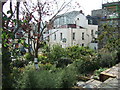


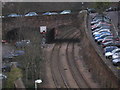
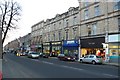

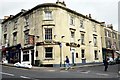
100 photos from this area
Area Information
Key information about the BS6 6TJ including its size, population, and administrative classification.
- Area Type
- Postcode
- Area Size
- 7335 m²
- Population
- Not available
- Population Density
- Not available
House Prices in BS6 6TJ
49
Properties
£848,806
Average Sold Price
£130,000
Lowest Price
£1,150,000
Highest Price
Showing 49 properties
| Address | Type | Beds | Baths | Last Sale Price | Last Sale Date | |
|---|---|---|---|---|---|---|
| 31 Burlington Road, Redland, Bristol, BS6 6TJ | Flat | 1 | 1 | £1,100,000 | Mar 2022 | |
| 23 Burlington Road, Redland, Bristol, BS6 6TJ | Terraced | - | - | £1,150,000 | May 2017 | |
| 15 Burlington Road, Redland, Bristol, BS6 6TJ | Terraced | 5 | - | £1,148,000 | Jul 2014 | |
| Flat 6, 13 Burlington Road, Redland, Bristol, BS6 6TJ | Flat | - | - | £910,000 | Sep 2013 | |
| 5 Burlington Road, Redland, Bristol, BS6 6TJ | Terraced | 5 | 2 | £885,000 | May 2010 | |
| 7 Burlington Road, Redland, Bristol, BS6 6TJ | house | - | - | £881,250 | Oct 2009 | |
| 11 Burlington Road, Redland, Bristol, BS6 6TJ | house | - | - | £660,000 | May 2005 | |
| 9 Burlington Road, Redland, Bristol, BS6 6TJ | Terraced | - | - | £775,000 | Jul 2004 | |
| 29 Burlington Road, Redland, Bristol, BS6 6TJ | Detached | 7 | 4 | £130,000 | Sep 1995 | |
| Flat 3, 19 Burlington Road, Redland, Bristol, BS6 6TJ | Maisonette | 2 | 2 | - | - |
Page 1 of 5
Energy Efficiency in BS6 6TJ
Amenities
Schools
| Rank | School | Type | Entry gender | Ages |
|---|
Explore more schools in this area
Go to Schools tabDemographics
Household Size
Two person
most common
Accommodation Type
Flats
most common
Tenure
52
majority
Ethnic Group
White
most common
Religion
N/A
most common
Household Composition
N/A
most common
Age
22
median
Young Adults (15-29 years)
most common
Household Deprivation
N/A
with no deprivation
NS-SEC
49
in Lower managerial occupations
Explore more demographic insights in this area
Go to Demographics tabPlanning
Planning Constraints
- Flood RiskPremium
- Ramsar Wetland SitesPremium
- Area of Outstanding Natural BeautyPremium
- Protected Nature ReservePremium
- Protected WoodlandPremium