Area Overview for BS6 6DT
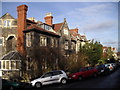
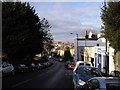
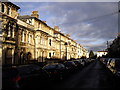
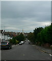
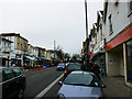
Photos of BS6 6DT


Area Information
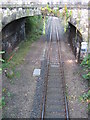
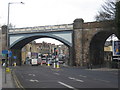
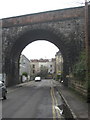
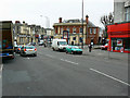
BS6 6DT lies on Cotham Lawn Road in Bristol’s Cotham area, a compact postcode within the city’s built-up region. This urban postcode is part of the Bristol City local authority and falls under the Cotham ward and Bristol Central constituency. The area is defined by its proximity to Cotham School, a key local institution, and its integration into Bristol’s broader transport network. Residents benefit from nearby railway stations, including Redland, just 1 km away, and multiple bus stops along Cotham Hill and Myrtle Road. The postcode’s location offers a mix of urban convenience and residential tranquillity, typical of Bristol’s inner-city clusters. With an average household income of £58,400 and a low Index of Multiple Deprivation rank (25,672), the area reflects a relatively affluent community. Daily life here is shaped by proximity to schools, including Cotham School and Cotham Gardens Primary, and access to nearby amenities. The area’s compact size means it is ideal for those seeking a balance between city living and quieter residential settings, with direct connections to Bristol’s cultural and commercial hubs.
- Area Type
- Postcode
- Area Size
- 8567 m²
- Population
- Not available
- Population Density
- Not available
The property market in BS6 6DT is characterised by a mix of residential housing types, though specific data on home ownership percentages or property sizes is not provided. The area’s low deprivation rank and average household income of £58,400 suggest a market skewed toward owner-occupied homes, typical of less deprived urban zones. Proximity to Cotham School and other local amenities may attract buyers prioritising family-friendly environments. Given the postcode’s compact size, property availability is likely limited, with competition focused on nearby areas such as Redland or Patchway. The presence of multiple schools, including Cotham School and Cotham Gardens Primary, may influence property values, with homes near these institutions potentially commanding premium prices. Buyers should consider the area’s urban setting and transport links when evaluating long-term viability, as the market may cater more to established residents than to first-time buyers.
House Prices in BS6 6DT
No properties found in this postcode.
Energy Efficiency in BS6 6DT
Amenities
Schools
| Rank | School | Type | Entry gender | Ages |
|---|
Explore more schools in this area
Go to Schools tabDemographics
BS6 6DT has a population predominantly composed of UK-born residents, making up 82% of the local demographic. The area’s Index of Multiple Deprivation rank of 25,672 places it among the least deprived postcode areas in the UK, indicating strong access to services, employment, and housing. This low deprivation score correlates with higher quality of life metrics, such as educational attainment and healthcare access. The average household income of £58,400 suggests a mix of middle- to upper-income families, though specific age profiles or household types are not detailed in the data. The presence of Cotham School and nearby primary schools implies a focus on family-oriented living, with homes likely catering to households with children. While exact figures on home ownership or age distribution are absent, the area’s low deprivation level and proximity to educational institutions suggest a stable, well-resourced community.
Household Size
Accommodation Type
Tenure
Ethnic Group
Religion
Household Composition
Age
Household Deprivation
NS-SEC
Explore more demographic insights in this area
Go to Demographics tabPlanning
Planning Constraints
- Flood RiskPremium
- Ramsar Wetland SitesPremium
- Area of Outstanding Natural BeautyPremium
- Protected Nature ReservePremium
- Protected WoodlandPremium