Area Overview for BS6 5TY
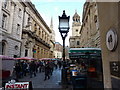
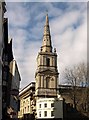
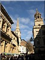
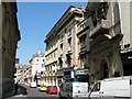
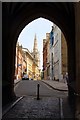
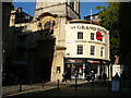
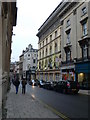
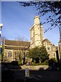
Photos of BS6 5TY

Area Information
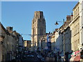
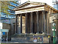
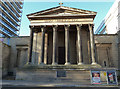
BS6 5TY is a postcode in Bristol, England, covering a small residential cluster in the Montpelier and St. Andrews areas. It lies within the broader BS postcode area, a well-known district in the South West of the UK. The postcode is geographically positioned at 51.461649°N, 2.59731°W, placing it in the heart of Bristol’s urban fabric. While BS6 5TY is listed as no longer in use in current postal records, the surrounding areas remain active and integral to the city’s character. Streets such as Cheltenham Road, Kingsdown Parade, Fremantle Square, and St. Matthews Road define the local landscape, blending residential and commercial zones. Living in BS6 5TY means being part of a historically rich part of Bristol, where the city’s architectural heritage meets modern urban living. The area is close to the city centre, offering easy access to cultural amenities, transport links, and the vibrant energy of Bristol’s core. However, the postcode’s deactivation suggests it may no longer be used for new mail or services, which prospective buyers should note when considering property transactions in the region.
- Area Type
- Postcode
- Area Size
- Not available
- Population
- 1870
- Population Density
- 11850 people/km²
The property market in BS6 5TY reflects the characteristics of Bristol’s inner-city residential areas. As a small postcode covering Montpelier and St. Andrews, the housing stock is likely to include a mix of terraced and semi-detached homes, typical of the city’s historic development patterns. The area’s proximity to the city centre makes it attractive for buyers seeking urban convenience, though the exact home ownership percentage is not specified in the data. Given Bristol’s broader trends, owner-occupation is likely to be significant, with rental demand also present due to the area’s accessibility. Buyers should consider that the postcode’s deactivation may affect property listings, as some addresses might no longer be actively marketed under this specific code. The immediate surroundings, including nearby streets like Fremantle Square and St. Matthews Road, offer a range of housing options, though the small size of the postcode means the market is tightly focused. Prospective buyers should explore adjacent areas for a fuller picture of available properties and their potential value.
House Prices in BS6 5TY
No properties found in this postcode.
Energy Efficiency in BS6 5TY
Amenities
Schools
| Rank | School | Type | Entry gender | Ages |
|---|
Explore more schools in this area
Go to Schools tabDemographics
Household Size
Accommodation Type
Tenure
Ethnic Group
Religion
Household Composition
Age
Household Deprivation
NS-SEC
Explore more demographic insights in this area
Go to Demographics tabPlanning
Planning Constraints
- Flood RiskPremium
- Ramsar Wetland SitesPremium
- Area of Outstanding Natural BeautyPremium
- Protected Nature ReservePremium
- Protected WoodlandPremium