Area Overview for BS6 5LG
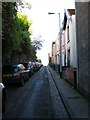
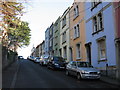
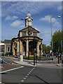
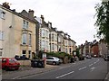
Photos of BS6 5LG


Area Information
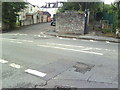
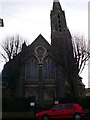
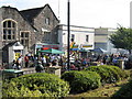
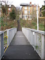
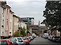
BS6 5LG is a small residential postcode in Bristol, England, located within the Ashley ward of the City of Bristol unitary authority. Situated at coordinates 51.468022 latitude and -2.581557 longitude, it is part of the broader BS6 postcode area, which forms part of Bristol’s built-up urban landscape. The area is characterised by historic architecture and a lively atmosphere, reflecting the city’s long-standing cultural and social vibrancy. Neighbouring transport options include the Montpelier train station, just 0 km away, and several bus stops such as Brook Road (W), Sevier Street (E/W), and Denbigh Street (NE), offering easy access to local amenities and the wider city. Living in BS6 5LG means being part of a compact, urban environment with proximity to Bristol’s central hubs. The postcode’s history, introduced in January 1980 and retired in 1995, adds a layer of local intrigue. This small area is ideal for those seeking a mix of convenience, historical charm, and connectivity to Bristol’s transport networks.
- Area Type
- Postcode
- Area Size
- Not available
- Population
- Not available
- Population Density
- Not available
House Prices in BS6 5LG
No properties found in this postcode.
Energy Efficiency in BS6 5LG
Amenities
Schools
| Rank | School | Type | Entry gender | Ages |
|---|
Explore more schools in this area
Go to Schools tabDemographics
Household Size
Accommodation Type
Tenure
Ethnic Group
Religion
Household Composition
Age
Household Deprivation
NS-SEC
Explore more demographic insights in this area
Go to Demographics tabPlanning
Planning Constraints
- Flood RiskPremium
- Ramsar Wetland SitesPremium
- Area of Outstanding Natural BeautyPremium
- Protected Nature ReservePremium
- Protected WoodlandPremium