Area Overview for BS6 5AY
Photos of BS6 5AY


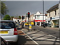
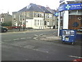


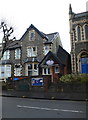


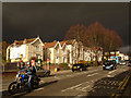
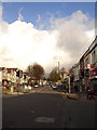
100 photos from this area
Area Information
Key information about the BS6 5AY including its size, population, and administrative classification.
- Area Type
- Postcode
- Area Size
- 1.5 hectares
- Population
- Not available
- Population Density
- Not available
House Prices in BS6 5AY
39
Properties
£473,675
Average Sold Price
£145,000
Lowest Price
£890,000
Highest Price
Showing 39 properties
| Address | Type | Beds | Baths | Last Sale Price | Last Sale Date | |
|---|---|---|---|---|---|---|
| 67 Effingham Road, Montpelier, Bristol, BS6 5AY | Terraced | 6 | 3 | £890,000 | Oct 2020 | |
| 99 Effingham Road, Montpelier, Bristol, BS6 5AY | Semi-detached | 5 | 1 | £733,000 | Dec 2016 | |
| 101 Effingham Road, Montpelier, Bristol, BS6 5AY | Terraced | - | - | £450,000 | Jun 2012 | |
| 91 Effingham Road, Montpelier, Bristol, BS6 5AY | house | - | - | £472,500 | Feb 2012 | |
| 87 Effingham Road, Montpelier, Bristol, BS6 5AY | house | - | - | £570,000 | Oct 2010 | |
| 65 Effingham Road, Montpelier, Bristol, BS6 5AY | house | - | - | £575,000 | Sep 2010 | |
| 83 Effingham Road, Montpelier, Bristol, BS6 5AY | Terraced | - | - | £442,000 | Feb 2004 | |
| 77 Effingham Road, Montpelier, Bristol, BS6 5AY | Semi-detached | - | - | £299,250 | Jan 2001 | |
| 79 Effingham Road, Montpelier, Bristol, BS6 5AY | house | - | - | £160,000 | Aug 1997 | |
| 73 Effingham Road, Montpelier, Bristol, BS6 5AY | Semi-detached | - | - | £145,000 | Mar 1997 |
Page 1 of 4
Energy Efficiency in BS6 5AY
Amenities
Schools
| Rank | School | Type | Entry gender | Ages |
|---|
Explore more schools in this area
Go to Schools tabDemographics
Household Size
Two person
most common
Accommodation Type
Flats
most common
Tenure
48
majority
Ethnic Group
White
most common
Religion
N/A
most common
Household Composition
N/A
most common
Age
22
median
Young Adults (15-29 years)
most common
Household Deprivation
N/A
with no deprivation
NS-SEC
47
in Lower managerial occupations
Explore more demographic insights in this area
Go to Demographics tabPlanning
Planning Constraints
- Flood RiskPremium
- Ramsar Wetland SitesPremium
- Area of Outstanding Natural BeautyPremium
- Protected Nature ReservePremium
- Protected WoodlandPremium