Area Overview for BS5 9AL
Photos of BS5 9AL

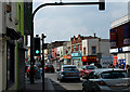
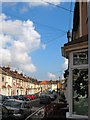
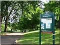
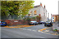


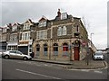
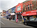
100 photos from this area
Area Information
Key information about the BS5 9AL including its size, population, and administrative classification.
- Area Type
- Postcode
- Area Size
- 5740 m²
- Population
- 1763
- Population Density
- 13033 people/km²
House Prices in BS5 9AL
36
Properties
£201,795
Average Sold Price
£82,500
Lowest Price
£450,000
Highest Price
Showing 36 properties
| Address | Type | Beds | Baths | Last Sale Price | Last Sale Date | |
|---|---|---|---|---|---|---|
| 33 Bourneville Road, Easton, Bristol, BS5 9AL | Terraced | 3 | 2 | £385,000 | Aug 2023 | |
| 35 Bourneville Road, Easton, Bristol, BS5 9AL | Terraced | 2 | 3 | £450,000 | Mar 2023 | |
| 17 Bourneville Road, Easton, Bristol, BS5 9AL | Terraced | 2 | 1 | £370,000 | Sep 2022 | |
| 18 Bourneville Road, Easton, Bristol, BS5 9AL | Terraced | 2 | 1 | £250,500 | Jul 2020 | |
| 7 Bourneville Road, Easton, Bristol, BS5 9AL | Terraced | 2 | 1 | £215,000 | Aug 2018 | |
| 15 Bourneville Road, Easton, Bristol, BS5 9AL | Terraced | 3 | 3 | £350,000 | Aug 2018 | |
| 21 Bourneville Road, Easton, Bristol, BS5 9AL | Terraced | 2 | 1 | £277,500 | Apr 2018 | |
| 11 Bourneville Road, Easton, Bristol, BS5 9AL | house | - | - | £242,500 | Jul 2017 | |
| 29 Bourneville Road, Easton, Bristol, BS5 9AL | Terraced | 3 | - | £199,995 | Jun 2016 | |
| 1 Bourneville Road, Easton, Bristol, BS5 9AL | Terraced | 1 | 1 | £255,000 | Jun 2016 |
Page 1 of 4
Energy Efficiency in BS5 9AL
Amenities
Schools
| Rank | School | Type | Entry gender | Ages |
|---|
Explore more schools in this area
Go to Schools tabDemographics
Household Size
One person
most common
Accommodation Type
Houses
most common
Tenure
50
majority
Ethnic Group
White
most common
Religion
N/A
most common
Household Composition
N/A
most common
Age
47
median
Adults (30-64 years)
most common
Household Deprivation
N/A
with no deprivation
NS-SEC
37
in Lower managerial occupations
Explore more demographic insights in this area
Go to Demographics tabPlanning
Planning Constraints
- Flood RiskPremium
- Ramsar Wetland SitesPremium
- Area of Outstanding Natural BeautyPremium
- Protected Nature ReservePremium
- Protected WoodlandPremium