Area Overview for BS5 8TZ
Photos of BS5 8TZ
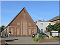

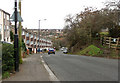
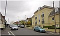
29 photos from this area
Area Information
Key information about the BS5 8TZ including its size, population, and administrative classification.
- Area Type
- Postcode
- Area Size
- 1.5 hectares
- Population
- 1563
- Population Density
- 3231 people/km²
House Prices in BS5 8TZ
28
Properties
£270,004
Average Sold Price
£79,000
Lowest Price
£560,000
Highest Price
Showing 28 properties
| Address | Type | Beds | Baths | Last Sale Price | Last Sale Date | |
|---|---|---|---|---|---|---|
| 38 Fir Tree Lane, St George, Bristol, BS5 8TZ | house | 4 | 2 | £560,000 | Nov 2025 | |
| 37 Fir Tree Lane, St George, Bristol, BS5 8TZ | Bungalow | 3 | 1 | £450,000 | Dec 2024 | |
| 6 Fir Tree Lane, St George, Bristol, BS5 8TZ | house | 3 | - | £355,555 | Jun 2023 | |
| 40 Fir Tree Lane, St George, Bristol, BS5 8TZ | Detached | 3 | 2 | £430,000 | Feb 2023 | |
| 4A Fir Tree Lane, St George, Bristol, BS5 8TZ | Semi-detached | 3 | 1 | £260,000 | Sep 2020 | |
| 46 Fir Tree Lane, St George, Bristol, BS5 8TZ | Detached | 4 | 1 | £406,000 | Jan 2020 | |
| 2 Fir Tree Lane, St George, Bristol, BS5 8TZ | Detached | 3 | 2 | £297,500 | Apr 2019 | |
| 10 Fir Tree Lane, St George, Bristol, BS5 8TZ | Terraced | 2 | 1 | £145,000 | Apr 2011 | |
| 12 Fir Tree Lane, St George, Bristol, BS5 8TZ | house | - | - | £165,000 | Dec 2008 | |
| 38A Fir Tree Lane, St George, Bristol, BS5 8TZ | Detached | - | - | £275,000 | Feb 2006 |
Page 1 of 3
Energy Efficiency in BS5 8TZ
Amenities
Schools
| Rank | School | Type | Entry gender | Ages |
|---|
Explore more schools in this area
Go to Schools tabDemographics
Household Size
Two person
most common
Accommodation Type
Houses
most common
Tenure
69
majority
Ethnic Group
White
most common
Religion
N/A
most common
Household Composition
N/A
most common
Age
47
median
Adults (30-64 years)
most common
Household Deprivation
N/A
with no deprivation
NS-SEC
42
in Lower managerial occupations
Explore more demographic insights in this area
Go to Demographics tabPlanning
Planning Constraints
- Flood RiskPremium
- Ramsar Wetland SitesPremium
- Area of Outstanding Natural BeautyPremium
- Protected Nature ReservePremium
- Protected WoodlandPremium