Area Overview for BS5 7TJ
Photos of BS5 7TJ

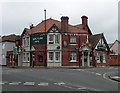
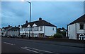
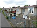
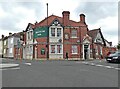
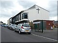
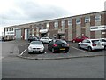
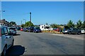
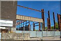
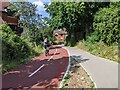
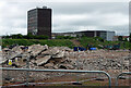
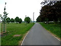
32 photos from this area
Area Information
Key information about the BS5 7TJ including its size, population, and administrative classification.
- Area Type
- Postcode
- Area Size
- 2.2 hectares
- Population
- Not available
- Population Density
- Not available
House Prices in BS5 7TJ
15
Properties
£222,355
Average Sold Price
£134,950
Lowest Price
£377,000
Highest Price
Showing 15 properties
| Address | Type | Beds | Baths | Last Sale Price | Last Sale Date | |
|---|---|---|---|---|---|---|
| 2A Whitefield Road, Speedwell, Bristol, BS5 7TJ | house | - | - | £285,000 | Jul 2025 | |
| 127 Whitefield Road, Speedwell, Bristol, BS5 7TJ | Terraced | 3 | 2 | £377,000 | Mar 2023 | |
| 35 Whitefield Road, Speedwell, Bristol, BS5 7TJ | Terraced | 3 | 1 | £249,600 | Aug 2019 | |
| 41 Whitefield Road, Speedwell, Bristol, BS5 7TJ | Terraced | 3 | 2 | £244,000 | Mar 2019 | |
| 125 Whitefield Road, Speedwell, Bristol, BS5 7TJ | Semi-detached | 3 | 1 | £265,000 | Nov 2017 | |
| 37 Whitefield Road, Speedwell, Bristol, BS5 7TJ | house | - | - | £154,000 | Aug 2014 | |
| 43 Whitefield Road, Speedwell, Bristol, BS5 7TJ | Semi-detached | 1 | 1 | £165,000 | Apr 2014 | |
| 33 Whitefield Road, Speedwell, Bristol, BS5 7TJ | house | - | - | £185,000 | Sep 2008 | |
| 1A Whitefield Road, Speedwell, Bristol, BS5 7TJ | Semi-detached | - | - | £164,000 | Feb 2007 | |
| 129 Whitefield Road, Speedwell, Bristol, BS5 7TJ | Terraced | - | - | £134,950 | Jul 2004 |
Page 1 of 2
Energy Efficiency in BS5 7TJ
Amenities
Schools
| Rank | School | Type | Entry gender | Ages |
|---|
Explore more schools in this area
Go to Schools tabDemographics
Household Size
Family (3-5 people)
most common
Accommodation Type
Houses
most common
Tenure
54
majority
Ethnic Group
White
most common
Religion
N/A
most common
Household Composition
N/A
most common
Age
47
median
Adults (30-64 years)
most common
Household Deprivation
N/A
with no deprivation
NS-SEC
29
in Lower managerial occupations
Explore more demographic insights in this area
Go to Demographics tabPlanning
Planning Constraints
- Flood RiskPremium
- Ramsar Wetland SitesPremium
- Area of Outstanding Natural BeautyPremium
- Protected Nature ReservePremium
- Protected WoodlandPremium