Area Overview for BS5 7QL
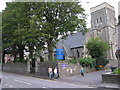
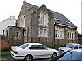
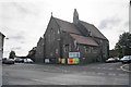
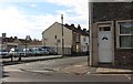
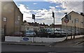
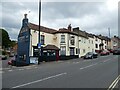
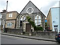
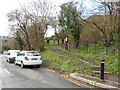
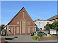
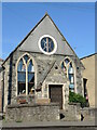
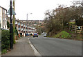
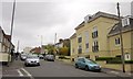
Photos of BS5 7QL
Area Information
Living in BS5 7QL means residing within St George Central, an electoral ward on the eastern edge of Bristol. This specific postcode covers just 3998 square metres, housing a tight-knit cluster of 1727 people. The location sits at the junction of Bell Hill Road and Two Mile Hill Road, areas centred on the A420 which runs through the neighbourhood's core. Historically, this area emerged from the hamlet of Don Johns Cross after the ecclesiastical parish was created in 1751. While originally part of Gloucestershire, St George became a civil parish in 1866 and merged with Bristol in 1898. The district developed significantly during the nineteenth and early twentieth centuries as an industrial community focused on coal mining and brick manufacturing. Following the closure of the East Bristol Colliery Company in 1936, the area transitioned through council-led housing development in the 1920s and beyond. Today, the ward includes parts of the St George and Speedwell neighbourhoods, reflecting a rich history that shaped its current residential character.
- Area Type
- Postcode
- Area Size
- 3998 m²
- Population
- 1727
- Population Density
- 6574 people/km²
Homes in BS5 7QL are characterised by a high rate of home ownership, with sixty-six percent of residents owning their property. This figure distinguishes the area from many parts of modern Bristol that rely heavily on short-term lets or student rentals. Houses form the predominant accommodation type, aligning with the historical development of the ward into council housing estates and terraced streets. The ownership rate suggests a market where long-term settlement is common, likely driven by the specific infrastructure of Victorian terraced houses and post-war council blocks that define the built environment. Buyers looking at this postcode are entering a residential zone with deep local roots, rather than a speculative development area. The concentration of ownership implies stability and a community where residents have invested in their surroundings over decades. Prospective buyers should expect a neighbourhood where housing turnover is generally lower, reflecting the tenure structure of the area.
House Prices in BS5 7QL
Showing 20 properties
| Address | Type | Beds | Baths | Last Sale Price | Last Sale Date | |
|---|---|---|---|---|---|---|
| 23 Dale Street, St George, Bristol, BS5 7QL | Terraced | 2 | 1 | £350,000 | Nov 2025 | |
| 1 Dale Street, St George, Bristol, BS5 7QL | house | - | - | £312,500 | Mar 2023 | |
| 3 Dale Street, St George, Bristol, BS5 7QL | Terraced | 2 | 1 | £285,000 | Mar 2021 | |
| 4 Dale Street, St George, Bristol, BS5 7QL | house | - | - | £272,000 | Aug 2018 | |
| 19 Dale Street, St George, Bristol, BS5 7QL | Terraced | 3 | 1 | £257,000 | Jun 2018 | |
| 5 Dale Street, St George, Bristol, BS5 7QL | Terraced | 2 | - | £254,055 | Sep 2017 | |
| 29 Dale Street, St George, Bristol, BS5 7QL | Terraced | 3 | 1 | £233,790 | Mar 2016 | |
| 25 Dale Street, St George, Bristol, BS5 7QL | Terraced | 3 | - | £175,000 | Jul 2014 | |
| 21 Dale Street, St George, Bristol, BS5 7QL | Terraced | 2 | 1 | £110,000 | Sep 2011 | |
| 15 Dale Street, St George, Bristol, BS5 7QL | Terraced | 2 | 1 | £169,000 | Jul 2007 |
Energy Efficiency in BS5 7QL
Residents of BS5 7QL enjoy excellent access to retail and transport amenities within practical reach. Five retail outlets are available nearby, including Tesco Bristol Bell and The Southern Co-operative Co, which serve daily grocery and shopping needs. Public transport links are diverse, with five ferry terminals such as Netham Lock Ferry Terminal and Temple Meads Station Ferry Landing offering water-based connections. Rail access is provided through five stations, including Lawrence Hill Railway Station and Stapleton Road Railway Station, linking the area to broader city networks. Two Metro stops at Oldland and Bitton sit close enough to offer direct public transit. Bristol Filton Airport is also located within reach, providing air travel options for residents. The area's lifestyle is heavily influenced by the A420 road network, which functions as a central artery. While the specific cluster of the postcode is residential, the proximity to these numerous transport and retail nodes means that daily errands and commuting require minimal travel time. Conveying between home and work, or school and centre, is straightforward.
Amenities
Schools
Encompass Education is the specific school listed nearest to BS5 7QL. This institution is designated as a special school, catering to children with diverse learning needs. The presence of a special school within the immediate vicinity highlights the area's focus on inclusive education and support for specific educational requirements. Families living in this postcode will have access to this facility for special needs provision. While the data does not list general primary or secondary schools within the immediate small cluster of the postcode, the presence of Encompass Education provides a dedicated educational resource for local children. The mix of school types in the wider St George Central ward supports a range of educational pathways, but within the specific boundaries of BS5 7QL, Encompass Education stands as the named educational establishment. Parents considering homes in this area should evaluate their educational needs against the provision available here.
| Rank | School | Type | Entry gender | Ages |
|---|
Explore more schools in this area
Go to Schools tabDemographics
The community in BS5 7QL is dominated by adults aged thirty to sixty-four years, with a median age of forty-seven. This older demographic profile suggests the area attracts families and established professionals seeking stability rather than a transient population. Sixty-six percent of residents own their homes outright, indicating a stable, owner-occupied neighbourhood rather than a high-turnover rental market. Houses form the primary accommodation type within this residential cluster. The predominant ethnic group is white, reflecting the historic composition of the area as it grew alongside the coal-mining industry. Unlike many modern urban estates built in the 1920s and beyond on the thirty-three acres acquired for council housing, the homes here retain strong ties to the industrial past. The population density is extremely high at 431,937 people per square kilometre, a figure that concentrates residents within a very small geographic footprint. This density creates an immediate sense of familiarity among neighbours, fostering a local environment where community interactions are frequent and direct.
Household Size
Accommodation Type
Tenure
Ethnic Group
Religion
Household Composition
Age
Household Deprivation
NS-SEC
Explore more demographic insights in this area
Go to Demographics tabPlanning
Planning Constraints
- Flood RiskPremium
- Ramsar Wetland SitesPremium
- Area of Outstanding Natural BeautyPremium
- Protected Nature ReservePremium
- Protected WoodlandPremium