Area Overview for BS5 7PY
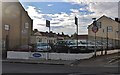
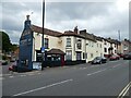
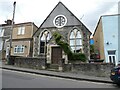
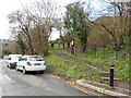
Photos of BS5 7PY
Area Information
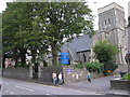
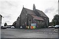
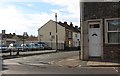
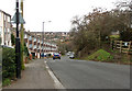
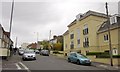
Living in BS5 7PY within the St George Central ward offers a grounded residential experience in east Bristol. You are situated in a specific postcode cluster covering 5,985 square metres of land. The area forms part of a community with deep history in coal mining and brick manufacturing, yet modern life here is defined by stable family households. The surrounding ward of St George Central has a population of 12,984, providing a sense of local community without excessive density. Your immediate neighbourhood includes properties near the A420 road, which serves as a key artery connecting you to areas like Kingswood and the wider city. The locality retains strong historical landmarks, including the church of St George and St George Park, a 38-acre green space laid out in 1894. You will find yourself in an area where the past shapes the architecture, featuring Victorian terraced houses and council estates that characterise the district. This small residential setting offers a quiet retreat while maintaining practical proximity to major transport links and local services. The blend of industrial heritage and established housing makes this a distinct choice for those seeking a residential area with tangible character rather than generic new builds. You are buying into a place with a clear story and defined boundaries.
- Area Type
- Postcode
- Area Size
- 5985 m²
- Population
- 1578
- Population Density
- 6616 people/km²
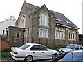
The property market in BS5 7PY is fundamentally characterised by house ownership rather than long-term renting. A clear majority of households own their homes, with 65% home ownership recorded across the area. This figure is significantly higher than the national average for many British cities, suggesting a community where people buy to stay. The predominant accommodation type consists of Houses, reflecting the Victorian and mid-20th-century development of the St George district. You will find streets of terraced properties and council housing estates that date back to the 1920s and beyond. This housing stock is distinct from modern apartment blocks or recent construction projects. Because most residents are owners, the rental market is likely segmented toward short-term letting or introductory tenancies rather than a robust private rental sector. If you are buying homes in BS5 7PY, you are entering a market with established value based on property rather than speculative development. The area does not feature high-rise living or new-builds as the primary stock. Instead, it offers existing structures that have served the community for decades. This stability means you are purchasing a part of the area's physical history. Your investment is tied to a legacy of housing that has evolved from the coal-mining era to the present day.
House Prices in BS5 7PY
Showing 21 properties
| Address | Type | Beds | Baths | Last Sale Price | Last Sale Date | |
|---|---|---|---|---|---|---|
| 74 Kingsway Avenue, St George, Bristol, BS5 7PY | house | - | - | £349,000 | May 2025 | |
| 76 Kingsway Avenue, St George, Bristol, BS5 7PY | house | - | - | £370,000 | Oct 2024 | |
| 71 Kingsway Avenue, St George, Bristol, BS5 7PY | house | 2 | 1 | £300,000 | Jul 2022 | |
| 73 Kingsway Avenue, St George, Bristol, BS5 7PY | house | - | - | £294,000 | Mar 2022 | |
| 75 Kingsway Avenue, St George, Bristol, BS5 7PY | house | - | - | £337,500 | Jun 2021 | |
| 60 Kingsway Avenue, St George, Bristol, BS5 7PY | Detached | 3 | 1 | £260,000 | Oct 2020 | |
| 82 Kingsway Avenue, St George, Bristol, BS5 7PY | Terraced | 2 | 1 | £234,000 | Jun 2020 | |
| 79 Kingsway Avenue, St George, Bristol, BS5 7PY | Semi-detached | 4 | - | £352,500 | Apr 2020 | |
| 70 Kingsway Avenue, St George, Bristol, BS5 7PY | Terraced | 3 | 2 | £310,000 | Mar 2020 | |
| 77 Kingsway Avenue, St George, Bristol, BS5 7PY | Semi-detached | 3 | 1 | £245,000 | Mar 2020 |
Energy Efficiency in BS5 7PY
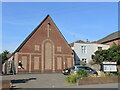
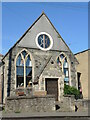
Your lifestyle in BS5 7PY is enriched by a collection of amenities within practical walking or driving distance. Retail options include five notable shops such as The Southern Co-operative Co, Spar Kingsway, and Sainsburys Bristol Nags. These venues are situated close to the residential cluster, ensuring you can shop locally without long journeys. For transport, five ferry landing spots are accessible, including Temple Bridge Ferry Landing, which links you to central Bristol. Rail travel is convenient with stations like Lawrence Hill and Stapleton Road nearby. If you require air travel, Bristol Filton Airport is less than a mile away. Leisure activities centre around St George Park, a 38-acre green space laid out in 1894. This area serves as a significant local amenity for residents seeking outdoor space. Historical sites add to the cultural fabric, such as the architecturally impressive former St George Grammar School site, now a Sikh Temple, and Avonview Cemetery. You can also visit Crofts End Mission, established in 1895 as a Christian work for miners' children. These features ground your daily life in the local history of coal mining and community service. Dining and shopping are self-sufficient within the immediate vicinity, reducing the need to travel far for essentials. The combination of green space and local high streets creates a balanced environment for family life.
Amenities
Schools
| Rank | School | Type | Entry gender | Ages |
|---|
Explore more schools in this area
Go to Schools tabDemographics
The people living in BS5 7PY represent a settled community with an average age of 47. Most residents fall into the adult age range of 30 to 64 years, indicating a population driven by established families and long-term homeowners. Home ownership is prevalent, with 65% of the area owner-occupied. This high level of retention suggests residents are deeply rooted in their properties. The predominant ethnic group within the ward is White, aligning with the broader demographic of east Bristol. You will encounter a neighbourhood where generations often stay, fostering strong local ties. The accommodation type is primarily Houses, fitting the historical development pattern of the region. With a population density of 263,647 people per square kilometre, the housing mix reflects a managed residential environment. Deprivation metrics are not provided in the available data, so you cannot assess economic hardship levels directly. However, the high home ownership rate and age profile imply financial stability among residents. You are looking at a demographic where life is often stationary, with fewer transient populations entering the market. This stability creates a predictable environment for neighbours who know their surroundings well over many years.
Household Size
Accommodation Type
Tenure
Ethnic Group
Religion
Household Composition
Age
Household Deprivation
NS-SEC
Explore more demographic insights in this area
Go to Demographics tabPlanning
Planning Constraints
- Flood RiskPremium
- Ramsar Wetland SitesPremium
- Area of Outstanding Natural BeautyPremium
- Protected Nature ReservePremium
- Protected WoodlandPremium