Area Overview for BS5 7JG
Photos of BS5 7JG
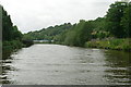
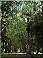
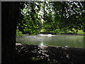
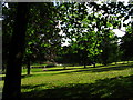
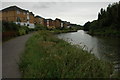
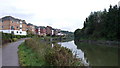
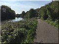
100 photos from this area
Area Information
Key information about the BS5 7JG including its size, population, and administrative classification.
- Area Type
- Postcode
- Area Size
- 4645 m²
- Population
- Not available
- Population Density
- Not available
House Prices in BS5 7JG
18
Properties
£226,504
Average Sold Price
£39,500
Lowest Price
£400,000
Highest Price
Showing 18 properties
| Address | Type | Beds | Baths | Last Sale Price | Last Sale Date | |
|---|---|---|---|---|---|---|
| 65 Plummers Hill, St George, Bristol, BS5 7JG | Terraced | 2 | 1 | £337,000 | May 2024 | |
| Fox Corner, 69 Plummers Hill, St George, Bristol, BS5 7JG | Terraced | 3 | - | £400,000 | Aug 2023 | |
| 59 Plummers Hill, St George, Bristol, BS5 7JG | Terraced | 2 | 2 | £385,000 | Jan 2023 | |
| 69E Plummers Hill, St George, Bristol, BS5 7JG | Semi-detached | 4 | 2 | £290,000 | May 2019 | |
| 63 Plummers Hill, St George, Bristol, BS5 7JG | Terraced | - | - | £105,065 | May 2019 | |
| 67 Plummers Hill, St George, Bristol, BS5 7JG | Terraced | 3 | 1 | £261,000 | Nov 2018 | |
| 51 Plummers Hill, St George, Bristol, BS5 7JG | Terraced | 2 | 1 | £255,000 | Jun 2017 | |
| 69C Plummers Hill, St George, Bristol, BS5 7JG | Semi-detached | 3 | 3 | £282,500 | Sep 2016 | |
| 69B Plummers Hill, St George, Bristol, BS5 7JG | Semi-detached | 3 | 3 | £235,000 | Mar 2016 | |
| 57 Plummers Hill, St George, Bristol, BS5 7JG | house | - | - | £192,000 | Mar 2015 |
Page 1 of 2
Energy Efficiency in BS5 7JG
Amenities
Schools
| Rank | School | Type | Entry gender | Ages |
|---|
Explore more schools in this area
Go to Schools tabDemographics
Household Size
Family (3-5 people)
most common
Accommodation Type
Houses
most common
Tenure
65
majority
Ethnic Group
White
most common
Religion
N/A
most common
Household Composition
N/A
most common
Age
47
median
Adults (30-64 years)
most common
Household Deprivation
N/A
with no deprivation
NS-SEC
35
in Lower managerial occupations
Explore more demographic insights in this area
Go to Demographics tabPlanning
Planning Constraints
- Flood RiskPremium
- Ramsar Wetland SitesPremium
- Area of Outstanding Natural BeautyPremium
- Protected Nature ReservePremium
- Protected WoodlandPremium