Area Overview for BS5 7DR
Photos of BS5 7DR


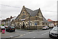
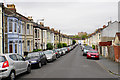
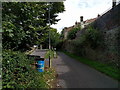
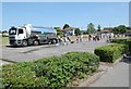


47 photos from this area
Area Information
Key information about the BS5 7DR including its size, population, and administrative classification.
- Area Type
- Postcode
- Area Size
- 5.3 hectares
- Population
- Not available
- Population Density
- Not available
House Prices in BS5 7DR
22
Properties
£176,495
Average Sold Price
£43,000
Lowest Price
£290,000
Highest Price
Showing 22 properties
| Address | Type | Beds | Baths | Last Sale Price | Last Sale Date | |
|---|---|---|---|---|---|---|
| 74 Gordon Road, Speedwell, Bristol, BS5 7DR | Semi-detached | 3 | 1 | £290,000 | Oct 2025 | |
| 68 Gordon Road, Speedwell, Bristol, BS5 7DR | house | - | - | £280,000 | Dec 2021 | |
| 73 Gordon Road, Speedwell, Bristol, BS5 7DR | house | - | - | £235,000 | Jan 2018 | |
| 76 Gordon Road, Speedwell, Bristol, BS5 7DR | house | - | - | £220,000 | Aug 2016 | |
| 84 Gordon Road, Speedwell, Bristol, BS5 7DR | Semi-detached | 3 | - | £167,000 | Mar 2014 | |
| 70 Gordon Road, Speedwell, Bristol, BS5 7DR | house | - | - | £166,000 | Oct 2007 | |
| 82 Gordon Road, Speedwell, Bristol, BS5 7DR | Semi-detached | - | - | £183,000 | Dec 2006 | |
| 78 Gordon Road, Speedwell, Bristol, BS5 7DR | restaurant_cafe | - | - | £115,000 | Aug 2002 | |
| 72 Gordon Road, Speedwell, Bristol, BS5 7DR | Semi-detached | - | - | £65,950 | Sep 1999 | |
| 84A Gordon Road, Speedwell, Bristol, BS5 7DR | Semi-detached | - | - | £43,000 | Mar 1997 |
Page 1 of 3
Energy Efficiency in BS5 7DR
Amenities
Schools
| Rank | School | Type | Entry gender | Ages |
|---|
Explore more schools in this area
Go to Schools tabDemographics
Household Size
Family (3-5 people)
most common
Accommodation Type
Houses
most common
Tenure
68
majority
Ethnic Group
White
most common
Religion
N/A
most common
Household Composition
N/A
most common
Age
47
median
Adults (30-64 years)
most common
Household Deprivation
N/A
with no deprivation
NS-SEC
43
in Lower managerial occupations
Explore more demographic insights in this area
Go to Demographics tabPlanning
Planning Constraints
- Flood RiskPremium
- Ramsar Wetland SitesPremium
- Area of Outstanding Natural BeautyPremium
- Protected Nature ReservePremium
- Protected WoodlandPremium