Area Overview for BS5 6RW
Photos of BS5 6RW

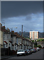
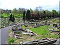
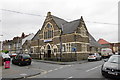
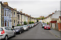

47 photos from this area
Area Information
Key information about the BS5 6RW including its size, population, and administrative classification.
- Area Type
- Postcode
- Area Size
- 5360 m²
- Population
- Not available
- Population Density
- Not available
House Prices in BS5 6RW
18
Properties
£243,283
Average Sold Price
£44,750
Lowest Price
£555,500
Highest Price
Showing 18 properties
| Address | Type | Beds | Baths | Last Sale Price | Last Sale Date | |
|---|---|---|---|---|---|---|
| 78 Stonebridge Park, Eastville, Bristol, BS5 6RW | Semi-detached | 5 | 3 | £515,000 | Nov 2024 | |
| 104 Stonebridge Park, Eastville, Bristol, BS5 6RW | Semi-detached | 3 | 2 | £555,500 | Sep 2023 | |
| 102 Stonebridge Park, Eastville, Bristol, BS5 6RW | Semi-detached | 3 | - | £409,000 | Feb 2022 | |
| 106 Stonebridge Park, Eastville, Bristol, BS5 6RW | Semi-detached | 3 | 1 | £330,000 | Feb 2019 | |
| 82 Stonebridge Park, Eastville, Bristol, BS5 6RW | Semi-detached | 4 | 3 | £270,000 | Sep 2016 | |
| 80 Stonebridge Park, Eastville, Bristol, BS5 6RW | house | 6 | 3 | £272,500 | Aug 2015 | |
| 86 Stonebridge Park, Eastville, Bristol, BS5 6RW | Semi-detached | 3 | 1 | £245,000 | Jan 2015 | |
| 96 Stonebridge Park, Eastville, Bristol, BS5 6RW | Terraced | 3 | 1 | £130,000 | May 2014 | |
| 98 Stonebridge Park, Eastville, Bristol, BS5 6RW | house | 3 | - | £180,000 | Mar 2011 | |
| 100 Stonebridge Park, Eastville, Bristol, BS5 6RW | house | - | - | £175,000 | Sep 2010 |
Page 1 of 2
Energy Efficiency in BS5 6RW
Amenities
Schools
| Rank | School | Type | Entry gender | Ages |
|---|
Explore more schools in this area
Go to Schools tabDemographics
Household Size
One person
most common
Accommodation Type
Houses
most common
Tenure
51
majority
Ethnic Group
White
most common
Religion
N/A
most common
Household Composition
N/A
most common
Age
47
median
Adults (30-64 years)
most common
Household Deprivation
N/A
with no deprivation
NS-SEC
31
in Lower managerial occupations
Explore more demographic insights in this area
Go to Demographics tabPlanning
Planning Constraints
- Flood RiskPremium
- Ramsar Wetland SitesPremium
- Area of Outstanding Natural BeautyPremium
- Protected Nature ReservePremium
- Protected WoodlandPremium