Area Overview for BS5 6HR
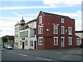
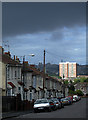
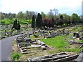
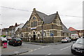
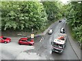
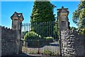
Photos of BS5 6HR


Area Information
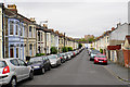
BS5 6HR lies in the Easton ward of Bristol, a compact postcode area within the BS5 district. This urban postcode is part of Bristol’s built-up region, blending historic character with modern living. Located 11.3 km from the sea, it sits near the city’s core, offering proximity to cultural hubs, green spaces, and transport links. The area is defined by its high population density — 7,131.8 people per square kilometre — reflecting a tightly packed, multicultural community. Over a third of residents identify as White, with the rest drawn from diverse backgrounds. Daily life here is shaped by its urban setting, with easy access to local amenities, schools, and public transport. The nearby Stapleton Road railway station is just 1 km away, while bus routes connect to surrounding parts of Bristol. Despite its density, the area is not without challenges; it falls within the moderately deprived rank of 11,159 nationally, which may influence access to services. For buyers, BS5 6HR offers a snapshot of Bristol’s evolving urban landscape, where affordability meets connectivity.
- Area Type
- Postcode
- Area Size
- Not available
- Population
- Not available
- Population Density
- Not available
The property market in BS5 6HR reflects the characteristics of Bristol’s urban core. With an average house price of £205,000 — below the UK average of £288,000 — the area offers relative affordability compared to other major cities. This pricing suggests a mix of owner-occupied homes and rental properties, though specific data on home ownership rates is not provided. The high population density of 7,131.8 per square kilometre indicates that the housing stock likely includes terraced and semi-detached properties, which are common in densely populated urban areas. Buyers should consider that the area’s moderate deprivation rank may influence property values and the availability of high-end listings. However, its proximity to transport links, including Stapleton Road station and multiple bus routes, enhances its appeal for commuters. For those seeking a balance between cost and convenience, BS5 6HR presents a viable option within Bristol’s broader property landscape.
House Prices in BS5 6HR
No properties found in this postcode.
Energy Efficiency in BS5 6HR
Amenities
Schools
| Rank | School | Type | Entry gender | Ages |
|---|
Explore more schools in this area
Go to Schools tabDemographics
The community in BS5 6HR is marked by its diversity, with 35% of residents identifying as White. This statistic reflects a broader trend in the BS5 postcode district, which includes Easton, Eastville, St George, and Whitehall. The area’s Index of Multiple Deprivation rank of 11,159 places it in the moderately deprived category nationally, suggesting that residents may face challenges accessing high-quality services or opportunities. However, the average household income of £42,300 aligns with Bristol’s economic profile, indicating a mix of working professionals and families. The area’s high population density — 7,131.8 per square kilometre — suggests a predominance of smaller homes, such as terraced or semi-detached properties, typical of urban living. While specific data on age profiles or household types is not available, the presence of local schools and transport links suggests a balance of young families and commuters. The deprivation rank highlights the need for investment in local infrastructure, but it also underscores the area’s role as a hub for accessible, affordable urban living.
Household Size
Accommodation Type
Tenure
Ethnic Group
Religion
Household Composition
Age
Household Deprivation
NS-SEC
Explore more demographic insights in this area
Go to Demographics tabPlanning
Planning Constraints
- Flood RiskPremium
- Ramsar Wetland SitesPremium
- Area of Outstanding Natural BeautyPremium
- Protected Nature ReservePremium
- Protected WoodlandPremium