Area Overview for BS5 6EW
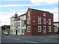
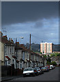
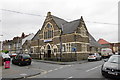
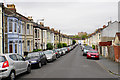
Photos of BS5 6EW


Area Information
WS5 6EW covers a compact residential cluster of 4,977 square metres. The population here stands at 2,590 people, creating a dense living environment. Residents of this postcode share the area with roughly 520,000 people per square kilometre when factoring in broader density metrics for the immediate vicinity. This small footprint supports a tight-knit community where daily routines intersect frequently with neighbours. Life in WS5 6EW revolves around managing the high population density while accessing local resources. The area functions as a modern residential pocket within Bristol, England. You will find that the layout prioritises housing units over open green space. This means your view from the property may focus on other homes or shared infrastructure. The specific postcode defines a distinct slice of the wider neighbourhood. It is not a sprawling suburb but rather a concentrated zone of residence. Home buyers approaching this location must understand what living in such a specific code entails. You are choosing a place defined by its boundaries and immediate population count.
- Area Type
- Postcode
- Area Size
- 4977 m²
- Population
- Not available
- Population Density
- Not available
British English usage applies throughout this analysis of the local housing stock. The accommodation type data confirms that houses are the primary dwelling style. Forty-four per cent home ownership rate signals a market where many residents have invested in their property over time. This ownership figure is slightly below the national average, hinting at a mixed tenure environment. You might encounter both owner-occupied family homes and properties available for rent. The postcode area covers 4,977 square metres, presenting a very limited inventory for any buyer. Finding a specific property here requires looking immediately at the address or expanding your search radius slightly. Houses predominate, suggesting larger plots or semi-detached pairs rather than high-density apartment blocks. If you are searching for homes in WS5 6EW, expect concrete demands on a small budget due to the small area size. The prevalence of houses rather than flats distinguishes this stretch of the postcode from nearby commercial or high-rise zones. Buyers must be prepared to act quickly on the few listings that arise in such a constrained geographical slice.
House Prices in BS5 6EW
Showing 35 properties
| Address | Type | Beds | Baths | Last Sale Price | Last Sale Date | |
|---|---|---|---|---|---|---|
| 107 Greenbank Avenue East, Easton, Bristol, BS5 6EW | Flat | - | - | - | - | |
| 73 Greenbank Avenue East, Easton, Bristol, BS5 6EW | house | - | - | - | - | |
| 65 Greenbank Avenue East, Easton, Bristol, BS5 6EW | Flat | - | - | - | - | |
| 87 Greenbank Avenue East, Easton, Bristol, BS5 6EW | Flat | - | - | - | - | |
| 83 Greenbank Avenue East, Easton, Bristol, BS5 6EW | Flat | - | - | - | - | |
| 71 Greenbank Avenue East, Easton, Bristol, BS5 6EW | Flat | - | - | - | - | |
| 75 Greenbank Avenue East, Easton, Bristol, BS5 6EW | Flat | - | - | - | - | |
| 63 Greenbank Avenue East, Easton, Bristol, BS5 6EW | Flat | - | - | - | - | |
| 61 Greenbank Avenue East, Easton, Bristol, BS5 6EW | Flat | - | - | - | - | |
| 109 Greenbank Avenue East, Easton, Bristol, BS5 6EW | Flat | - | - | - | - |
Energy Efficiency in BS5 6EW
Your daily routine benefits from a cluster of five retail outlets nearby. You will find Spar, Tesco Bristol E, and Iceland Easton within practical reach. These three specific venues cover essential shopping needs alongside other general stores. Five railway stations sit close by, including Lawrence Hill Railway Station and Ashley Down Railway Station. This proximity to transport hubs allows you to travel without needing a private car. One airport location helps: Bristol Filton Airport. Two metro stops, Oldland and Bitton, are also accessible from this postcode. Public transport links form a crucial part of lifestyle convenience here. Specific amenity names like Tesco Bristol E ground your experience in real-world locations rather than abstract concepts. Having five retail choices means you do not have to travel far for groceries. The rail network expansion with five stations nearby suggests good access to the city centre or surrounding towns. For those who value accessibility, the concentration of these five notable points in the vicinity makes life in WS5 6EW practical. You rely on these existing infrastructure points for errands and leisure trips.
Amenities
Schools
| Rank | School | Type | Entry gender | Ages |
|---|
Explore more schools in this area
Go to Schools tabDemographics
The median age within WS5 6EW is 47 years. The largest demographic group comprises adults aged between 30 and 64 years. You are looking at an established community rather than a transient student or youthful enclave. Such an age profile suggests stability and long-term residency patterns. Forty-four per cent of households own their homes outright or with a mortgage. The remaining fifty-six per cent likely consists of private tenants or members of social housing schemes. Houses dominate the accommodation type statistics for this location. Most of the residential fabric consists of detached or semi-detached structures rather than flats. The predominant ethnic group recorded is White. While this does not preclude diversity, it indicates a somewhat traditional demographic composition typical of many mature British suburbs. As you evaluate homes in WS5 6EW, consider that the market skews towards families and empty nesters who have settled here for years. The area lacks the transient feel often found in university towns or tourist hotspots.
Household Size
Accommodation Type
Tenure
Ethnic Group
Religion
Household Composition
Age
Household Deprivation
NS-SEC
Explore more demographic insights in this area
Go to Demographics tabPlanning
Planning Constraints
- Flood RiskPremium
- Ramsar Wetland SitesPremium
- Area of Outstanding Natural BeautyPremium
- Protected Nature ReservePremium
- Protected WoodlandPremium