Area Overview for BS5 0XW
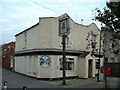
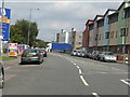
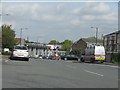
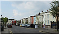
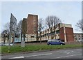
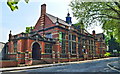
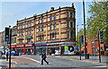
Photos of BS5 0XW

Area Information
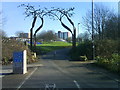
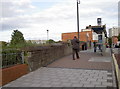
BS5 0XW lies in Bristol, England, within the Lawrence Hill ward, at coordinates 51.460865 latitude and -2.574269 longitude (grid reference ST601736). It is a small residential postcode area, part of the broader BS5 postcode district. The area is bordered by nearby postcodes such as BS5 0NW and BS5 0PW, which share similar characteristics. Its proximity to the M32 motorway and the city centre makes it accessible for commuters. The small cluster of homes here suggests a compact, tight-knit community. Living in BS5 0XW means being part of Bristol’s established residential fabric, with a mix of housing types and a focus on local amenities. The area’s size and specific postcode designation indicate a deliberate, perhaps historic, division of the city’s housing stock. For buyers, this means a focused search with limited options, but potentially fewer competing properties. The surrounding areas, including BS5 0PW, offer additional context for understanding the broader housing market.
- Area Type
- Postcode
- Area Size
- Not available
- Population
- 2535
- Population Density
- 6694 people/km²
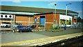
The property market in BS5 0XW reflects its status as a small, defined postcode area. While specific home ownership percentages are not provided, the description of it as a “specific postcode area covering a small residential cluster” suggests a mix of owner-occupied and rental properties. The types of accommodation here are likely to include terraced houses, flats, and semi-detached homes, typical of Bristol’s older residential districts. The compact nature of the area means buyers must consider the immediate surroundings, such as nearby postcodes like BS5 0NW and BS5 0PW, which may offer similar housing stock. This small cluster could indicate a stable market with limited turnover, appealing to those seeking a quieter, more contained environment. However, the lack of detailed data on property prices or recent transactions means buyers should focus on local listings and broader Bristol property trends for context.
House Prices in BS5 0XW
No properties found in this postcode.
Energy Efficiency in BS5 0XW
Amenities
Schools
| Rank | School | Type | Entry gender | Ages |
|---|
Explore more schools in this area
Go to Schools tabDemographics
Household Size
Accommodation Type
Tenure
Ethnic Group
Religion
Household Composition
Age
Household Deprivation
NS-SEC
Explore more demographic insights in this area
Go to Demographics tabPlanning
Planning Constraints
- Flood RiskPremium
- Ramsar Wetland SitesPremium
- Area of Outstanding Natural BeautyPremium
- Protected Nature ReservePremium
- Protected WoodlandPremium